Bush-bashing off the Routeburn Track to Find a Hidden Waterfall the DOC No Longer Maintains
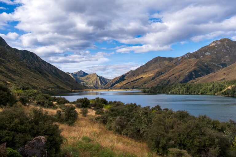
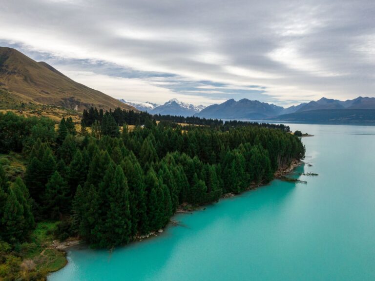
You’ve heard the stories about New Zealand’s Great Walks. The Routeburn Track, you know, is one of the poster children—a pristine alpine corridor of beech forest, tussock-lined ridges, and ice-carved valleys that connects two national parks. It’s the kind of hike you book months in advance, where the huts are booked solid and the Department of Conservation (DOC) keeps every boardwalk, every bridge, every step resolutely grade-one perfect. But what if you’re the kind of traveler who, halfway along a perfectly curated trail, spots a narrow, overgrown slit in the bush and feels a pull that the map doesn’t acknowledge? That’s how you found yourself on your big New Zealand road trip, bush-bashing off the Routeburn Track to find a hidden waterfall the DOC no longer maintains. And you learned the hard way that some secrets stay secret for good reason.
The decision came somewhere between the Routeburn Falls Hut and the Harris Saddle, when you glanced at a DOC sign that had been weathered nearly illegible. One arrow pointed forward, toward the official route; another, almost entirely faded, pointed to a faint indentation in the scrub. A fellow hiker had mentioned, with a conspiratorial wink, that there used to be a track to a waterfall called “the Veil,” but the DOC had stopped maintaining it years ago. You pictured a curtain of water plunging through untouched forest, no crowds, no handrails, no signs telling you where to stand. You imagined the raw, unmediated New Zealand you’d come here to find. What you didn’t imagine was the five hours of route-finding, the stinging cuts from matagouri, and the moment you’d have to decide whether to risk a crumbling stream bank or turn around. Here’s what you wish you’d known before you left the maintained trail.
The Entrance That Didn’t Feel Like a Decision
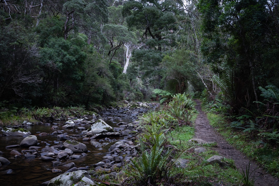
The entrance to the old track was a barely-there gap in the beech forest, a narrow corridor where the undergrowth pressed in on both sides. You pushed through, and within twenty paces, the world changed. The sound of other hikers—the chatter, the boots on boardwalk—vanished behind you. The air grew still and damp, smelling of leaf litter and slow decay. The ground beneath your feet became a jumble of moss-covered roots, slippery with decades of undisturbed rain. This was the moment you felt that rush, that thrill of discovery, that sense of being the only person to have walked this way in years.
But here’s what the thrill doesn’t tell you: an unmaintained track in New Zealand isn’t just “overgrown.” It’s actively reclaiming itself. The fallen branches that look like convenient stepping stones—they’re rotted through and will crack under your weight. The streams you’ll want to follow as a navigation aid—they change course with every heavy rainfall, leaving you on a dry bank when the water’s gone elsewhere. The “track” becomes a series of guesses: a ribbon tied to a branch here, a faded DOC marker there that looks like it was hammered into a tree a decade ago. You found yourself checking your phone’s GPS every few minutes, watching the blue dot drift across a map that didn’t even show this track. You were bush-bashing, but with an audience: the silent, watchful forest that knew exactly where it wanted you to go.
The Veil, Split Into Three Streamers
After two hours of slow progress, you consulted the notes you’d scribbled from an old topographical map. The waterfall should have been fifteen minutes from the last creek crossing. You scanned the valley ahead and saw nothing but a dense wall of beech and ferns. No white water visible. No thunderous roar. Just the sound of a dripping canopy and a distant bird. You started to doubt yourself. What if the waterfall had dried up in the summer drought? What if you’d taken the wrong fork back at the fallen tree? What if the DOC had decommissioned this track precisely because the waterfall no longer existed?
Then you heard it—a faint, muffled rumble, like traffic from a highway you hadn’t noticed. You turned toward the sound and pushed through a thicket of supplejack, and there it was: the Veil. Except it wasn’t a single curtain of water. It was a series of cascades, maybe thirty meters total, dropping through a narrow chasm that was barely wider than your shoulders. The water hit a rock shelf, then split into three streamers that fell into a dark pool below. It was beautiful, but not in the way the official Routeburn waterfall views are. This was a wild, awkward, untidy beauty—the kind that doesn’t pose for photographs. The pool was full of fallen branches. The rock faces were slick with algae. There was no place to sit, no vantage point that gave you the whole thing in one frame. You had to stand in the spray, craning your neck, to see each section individually. And you loved it for that imperfection. But you also realized you’d spent more time getting here than you would spend actually enjoying the destination.
The Swing Bridge and the Math of Daylight
When you’d made the decision to bush-bash, you’d assumed the detour would add maybe an hour to your day. You were wrong. The two hours out turned into three when you lost the track on the return and had to backtrack along a streambed. Then you had to regain the altitude you’d lost. By the time you stumbled back onto the official Routeburn Track, you had less than four hours of daylight left to cover the remaining five kilometers to the next hut. The math was tight, and New Zealand’s Southern Alps don’t care about your schedule.
You remember the crossing of a swing bridge over a gorge. The wind picked up, and for the first time on the trip, you felt a genuine flicker of fear. The plan had been to reach the Lake MacKenzie Hut before the sun dropped behind the Humboldt Mountains. But the bush-bash had eaten four hours. You now had to choose: push hard and risk an injury on the uneven track, or call it and find a spot to camp without a permit. Neither option was good. You ended up speed-walking the last section, your quads screaming, your headlamp already out and strapped to your pack because the forest had gone dusky. You pulled into the hut at 9:15 p.m., just as the last of the twilight faded. The hut warden gave you a look that said everything.
The Slip That Ended the Old Track
Experienced backcountry travelers tend to follow a few unwritten rules that you broke: never add more than 30 percent to your estimated travel time for an unmarked route; always carry a paper map and compass, not just a phone with a battery that drains faster in wet forest; and, crucially, check the DOC signage at the trailhead for any red notices about “decommissioned tracks.” On the Routeburn, there’s a small information board at the Divide Shelter that lists all the historic routes in the area. You walked right past it because you were focused on starting the main track.
The DOC doesn’t stop maintaining a track on a whim. Usually, it’s because the route is unstable, because of active erosion, or because the waterfall itself has changed—a landslide may have redirected the water, a slip may have made the approach dangerous. You found evidence of all three. The old track ended at a fresh slip, a raw gash of grey rock and shattered trees, and you had to climb around it on a slope that had no solid footing. If you’d slipped there, alone, with no phone signal, the rescue would have been a multi-day operation. You’re grateful you didn’t, but you understand now why the Veil is no longer on the map. It’s not coming back, either.
Flagging Tape and the Scratch of Matagouri
Your Routeburn packing list was sensible for the official track: layers, rain jacket, gaiters, trekking poles, first-aid kit. But none of it was suited for bush-bashing. You spent the first hour picking fluffy seeds and twigs out of your rain jacket’s zipper. Matagouri, the native thorn bush, tore two small holes in your favorite hiking pants. You didn’t have a pair of lightweight work gloves, and your hands took a beating from pushing through scratchy shrubs. You didn’t have a machete or even a folding saw, though you’re not sure you’d have used one on a DOC track. But you sure wished for them when you spent fifteen minutes fighting through a thicket of horopito that hadn’t felt a boot in years.
The one item that saved you was a small, cheap roll of bright orange flagging tape. On the way in, you tied it to branches at key junctions—where the stream crossed, where the old track switched back. On the way out, in the fading light, those orange strips were the only thing that kept you from wandering into a dead-end gully. You’d read that trick in an online forum the night before your trip, and you’re convinced it’s the only reason you didn’t get lost for good.
The Hut Deck and the Milky Way
You sat on the hut deck that night, your legs aching, your hands scratched, your pack smelling of wet wool and crushed fern. You were looking up at a sky so full of stars that the Milky Way looked like a river of milk. You’d seen something that maybe two dozen people had seen in the last year. The waterfall wasn’t on Instagram. There were no photos of people doing yoga poses on its rocks. It was yours alone, not because you’d claimed it, but because you’d earned it.
You remember the silence before you heard the water, the way the light through the forest canopy turned everything a luminous green, and the sense that for a few hours, you were completely off the grid of human intention. You also remember that the DOC knows what it’s doing when it closes a track. You respect that now. But you also know that sometimes, the best adventures live right at the edge of what’s recommended—provided you go in with your eyes open, your gear enough, and your timing generous.
Next time you find yourself staring at a faded sign on a Great Walk, you’ll pause. You’ll check the map. You’ll add an extra two hours to your estimate. And you’ll think about the Veil, and you’ll smile, and you’ll probably still go. But you’ll go smarter, and that’s the whole point of a story like this. It’s a warning and an invitation, wrapped together in scratched-up skin and the smell of beech forest after rain.
📷 Photos: pen_ash (Unsplash)