The first railway bridge I found was on the wrong side of a valley. I could see the rusted trestles, the sagging line of the old track bed, the way the vegetation had begun to reclaim the gravel between the sleepers. It sat about four hundred metres away, across a scrubby slope I hadn’t accounted for on the map, and between me and it was a fence that wasn’t marked on any tourist guide: a low, barbed-wire affair, the kind that says “keep out” without needing a sign to do so. I had driven for nearly two hours from Seoul to reach this spot, a promontory near the southern edge of the Civilian Control Zone, and now the sun was starting to drop behind the ridgeline. The light was good. The bridge was unreachable.
The DMZ buffer zone is a strange kind of landscape. It isn’t a single line on a map, but a series of overlapping restrictions and permissions that shift depending on which military checkpoint you pass through. The abandoned railway bridges that cross its ravines and riverbeds are relics of the Gyeongui Line, which once connected Seoul to Sinuiju on the Chinese border, and then—after the armistice—became a severed thread. Some of these bridges are inside the Civilian Control Zone proper, accessible only with a permit from the local military unit. Others sit just outside it, technically public land but practically forgotten, reachable by dirt tracks that don’t appear on any GPS database.
I had been told, by a former military photographer I’d met at a cafe in Hongdae, that the best approach was to treat the whole area as a puzzle rather than a destination. “Don’t aim for a specific bridge. Aim for a valley that contains one. Then figure out the access.” I had scribbled that down, thinking it sounded like the kind of vague advice that only makes sense after you’ve already been there, or something like that. It turned out to be exactly right.
The first bridge I actually managed to photograph was not the one I’d originally set out to find. That morning, I had driven past a checkpoint just north of Paju, where a soldier in his early twenties asked me—in the slow, deliberate English of someone who has practiced a script—what my purpose was. I told him photography. He looked at my car, a rented Kia with a camo tarp over the back seat, and asked if I was a journalist. No, I said. Just curious. He nodded, handed back my passport, and waved me through with the same flat expression he’d used on the car before mine.
The road beyond the checkpoint was good asphalt for about two kilometres, then turned to gravel, then to dirt crusted with frost that crunched under the tyres. I parked at a pullout where a rusted sign marked the trailhead for something called “Unification Observatory Trail,” which turned out to be a path that led to a viewing platform aimed north toward North Korea—visible as a dark smear of hills on the horizon—and not toward any bridge at all. I could hear water running somewhere below, a creek or a stream, and the sound of a chainsaw starting up in the near distance. A farmer, probably, clearing scrub. The air smelled of cold earth and diesel.
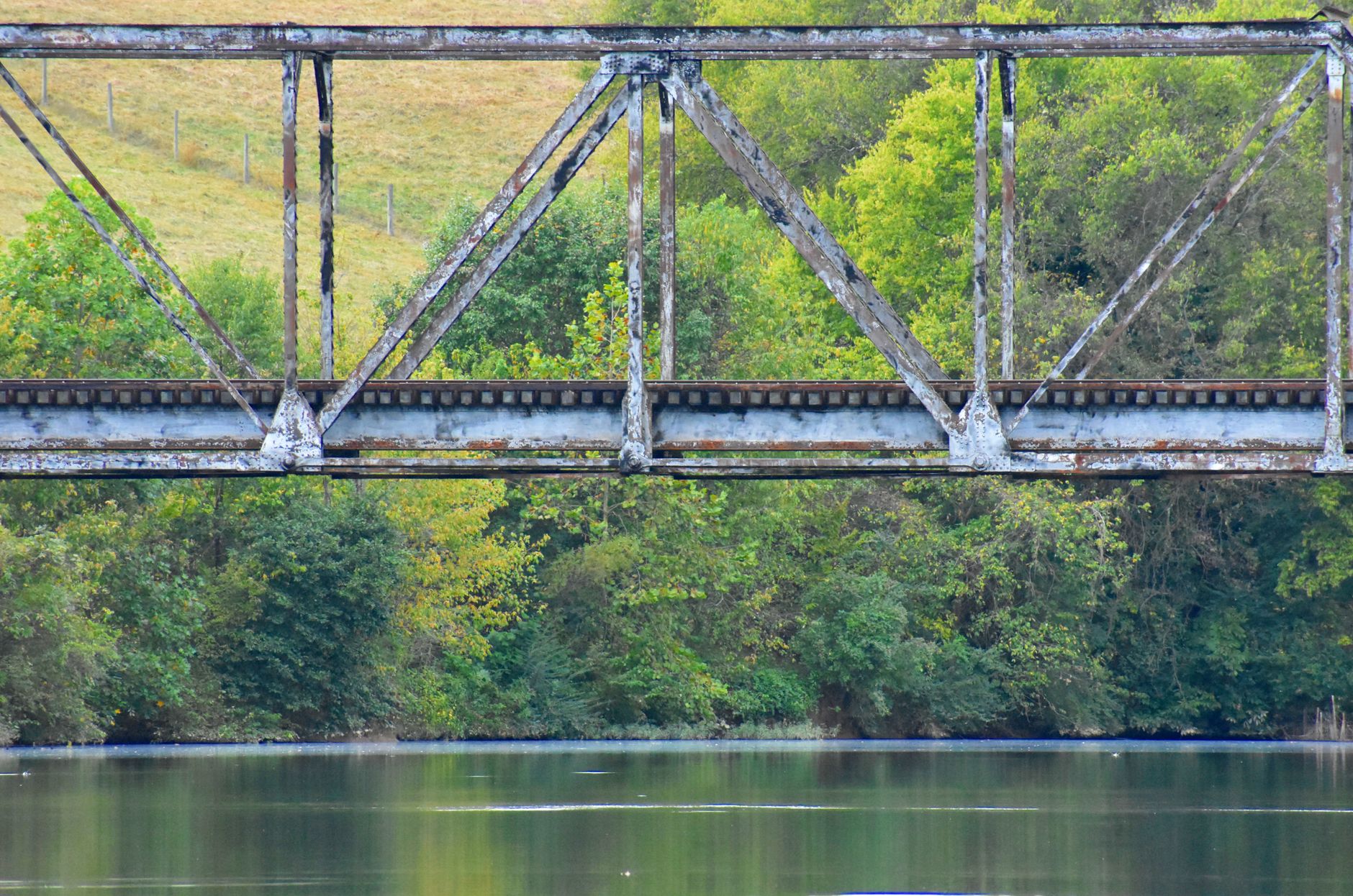
I had brought a 70-200mm lens and a 1.4x teleconverter, which I’d assumed would be long enough to reach the bridges from any safe vantage point. The first bridge I spotted that day disproved that assumption immediately. It was a single-span steel truss, maybe a hundred metres long, crossing a dry riverbed about six hundred metres away. Even at 280mm, it filled barely a third of the frame. The detail I wanted—the way the rust had eaten through the rivet heads in a pattern that looked deliberate—was invisible. I took a shot anyway, as a record, and then spent the next hour walking the edge of a soybean field trying to find a closer angle. The field ended at a drainage ditch, which led to a thicket of reeds taller than my head, which led to a secondary fence. I never got closer than five hundred metres.
That evening, back in a motel in Munsan, I sat on the bed with the map spread out and marked the spots where I could see the line of the old railway from satellite imagery. The bridges were easy to identify: thin steel threads crossing the darker bands of valleys. What the satellite didn’t show was the condition of the access tracks, the presence of fences, or the height of the vegetation. I spent an hour cross-referencing with a terrain app on my phone, noting which bridges faced south and would catch the best morning light. The following day, I would try again.
What I learned on that second day was that the buffer zone has a rhythm. The military patrols follow a schedule—or at least a predictable pattern—and the window of quiet between them is when you can work without feeling watched. I arrived at a bridge near the village of Neolgeumok at about ten in the morning, later than I’d intended, and found a farmer sitting on the rail of the bridge itself, eating a pear. He was an old man in a padded vest and rubber boots, and he did not seem surprised to see a photographer walking toward him with a tripod over one shoulder. He gestured at the bridge and said something in Korean that I didn’t catch. I smiled and shrugged. He laughed, peeled another pear, and offered me half.
This bridge was different from the others. It was shorter, maybe forty metres, and the track bed had been partially removed, leaving the steel beams exposed like ribs. The farmer, it turned out, used it as a shortcut between two sections of his land that had been separated by the railway’s abandonment. He crossed it every day, he said—I got this from a younger man who appeared from a nearby shed and translated—and he’d never once thought to light it up with a camera. I set up my tripod on the far bank, where the morning light was catching the rust in a way that made the steel look almost warm, and took a series of shots at 200mm: the bridge in its setting, the farmer crossing it, the way the trees on the far side had grown up through the sleepers.
The detail that surprised me was the sound. I had expected silence, or the ambient noise of wind and birds, but the bridge itself produced a low hum when the wind hit it at the right angle—a vibration through the steel that you could feel in your chest if you stood close enough. I asked the younger man about it. He shrugged. “Old metal. It sings.”
I spent the middle of that day driving the back roads between the CCZ villages, stopping wherever I saw a glimpse of rust through the trees. Some of these roads were paved but barely wide enough for a single car, and I had to reverse twice to let military vehicles pass. The soldiers in the vehicles barely glanced at me. I was just another person in a rented car on a road that happened to go through a restricted area. The tension I’d felt on the first day—the sense of being watched, of doing something I shouldn’t—had subsided into something more practical: finding the shot, moving before the light shifted, not getting stuck in the mud.
The bridges are not all the same. Some are massive, double-decker structures built to carry two lines of track across wide river valleys. Others are small, almost incidental, crossing gullies that had once seemed important enough to justify a steel span. The condition varies wildly: one bridge I found had been freshly painted—some kind of military maintenance, I later guessed—while another had collapsed at one end, its deck tilting toward the ground like a ramp. I photographed both, and the differences told a story about which parts of the buffer zone were still considered strategically important and which had been allowed to decay.
On the third day, I made a discovery that changed how I thought about the whole project. I had been following a dirt track along the edge of a ridge, looking for a bridge I’d marked on my map, when I came to a clearing that opened onto a view I hadn’t anticipated. Below me, in a valley perhaps two hundred metres deep, was a bridge of extraordinary scale: a four-span steel viaduct, its piers rising from the forest floor like the legs of a giant insect. The track bed was intact, the lines still visible, and the whole structure was covered in a patina of rust that the afternoon sun turned a deep ochre. I stood at the edge of the clearing for a long moment, not even reaching for my camera. The scale of it was hard to process: this was not a forgotten bridge but a major piece of infrastructure, abandoned not because it was unimportant but because the geography of the border had made it irrelevant.
Getting closer was not straightforward. The slope was steep and covered in loose shale, and the vegetation at the bottom was dense with thorns. I spent forty minutes picking my way down, sweating despite the cold, and when I finally reached the base of the nearest pier, I found a plaque bolted to the concrete. It was in Japanese, from the colonial period, and gave the date of construction as 1939. The bridge had been built to carry the Gyeongui Line’s wartime traffic, and it had been in use for barely six years before the peninsula was divided. I photographed the plaque, the rusted bolts, the way the steel had buckled slightly at one of the expansion joints—a detail I’d never have seen from the ridge above.
The light was fading by the time I climbed back up. I sat on the edge of the clearing, sweat cooling on my skin, and watched the bridge below me turn from ochre to deep blue as the sun dropped behind the hills. A hare crossed the track behind me, unconcerned. I had not eaten since breakfast, and my hands were shaking slightly from the climb and the cold. But I had the shot. Or rather, I had a series of shots—some from the ridge, some from the valley floor, some that I knew would work and some that I’d only understand when I saw them on a screen. The bridge itself didn’t care. It had been there for eighty years, and it would be there for eighty more, rusting in its valley, waiting for someone to come and look.
Driving back toward the main road in the dark, I passed the same checkpoint from the first morning. The soldier on duty was different—a woman this time, younger, with the same practiced English. She asked where I’d been. I told her the general area. She nodded, handed back my passport, and said, in a tone that was almost friendly, “Be careful. The deer are active at this hour.” I thought about the hare I’d seen, and about the bridge in its valley, and about the farmer who crossed his bridge every day without thinking to photograph it. Some places are worth the effort, and some are worth the effort of finding out that the effort was part of the point. The bridges of the buffer zone belong to the second category.

📷 Photos: Jessa Leigh (Pexels), Julia Fuchs (Pexels)