Hunting Down the Abandoned Rail Bridge in the Cameron Highlands Where the Train Stopped 40 Years Ago
Hunting Down the Abandoned Rail Bridge in the Cameron Highlands Where the Train Stopped 40 Years Ago
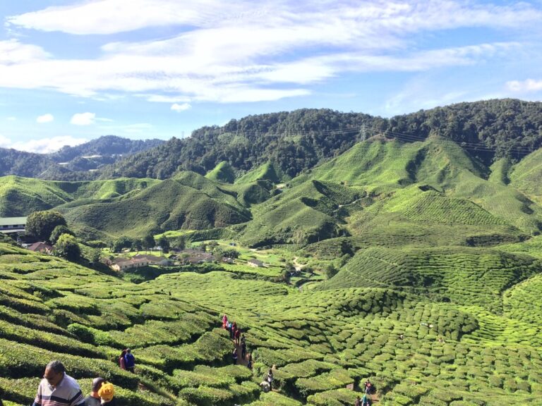
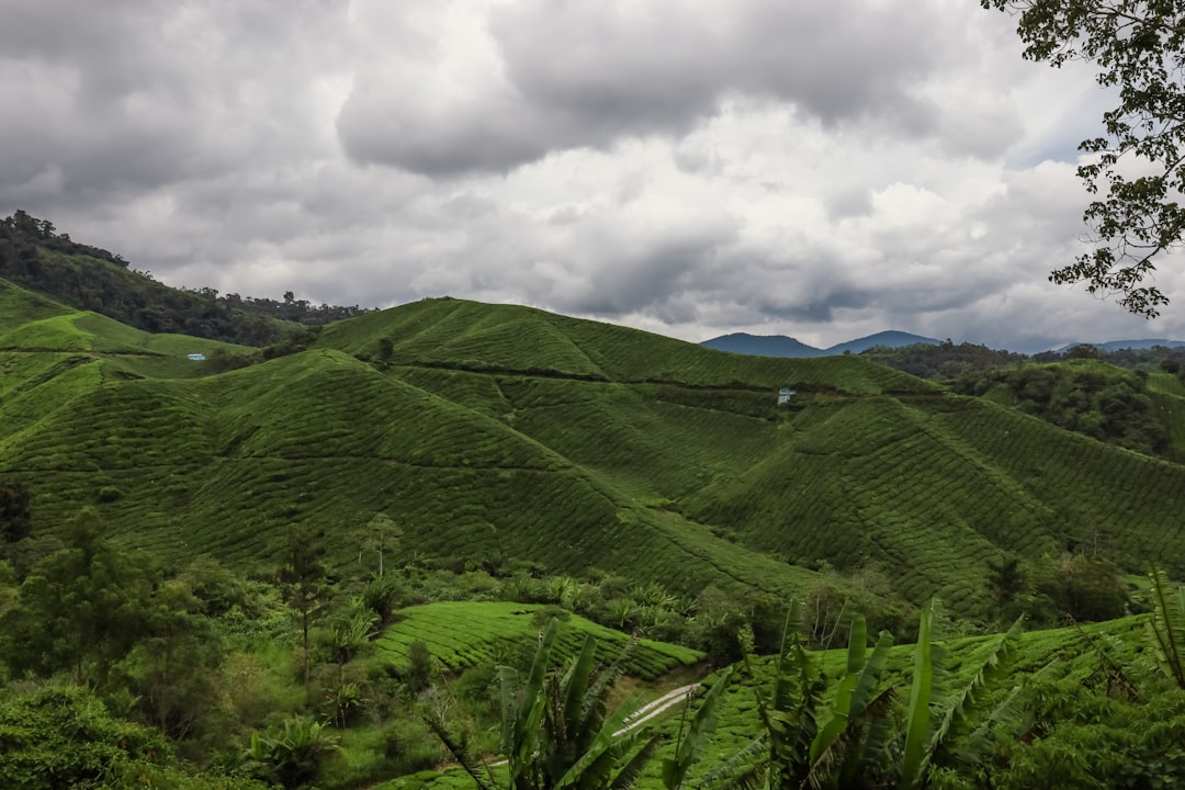
The Cameron Highlands are known for tea plantations, strawberry farms, and cool air, but a lesser-known relic of an old railway project lies hidden in the jungle. Somewhere along the abandoned track bed of a line that never reached completion, a rusted steel bridge spans a ravine, slowly being reclaimed by the forest. Most coverage of the highlands skips this entirely, but for those willing to do a bit of groundwork, it offers a genuinely unusual half-day outing that combines history, a moderate jungle hike, and the particular quiet of a place that has been left alone for decades.
The Railway That Never Arrived
The abandoned rail bridge is a remnant of a defunct logging railway, not a mainline passenger service. In the 1970s and early 1980s, a logging company operated a narrow-gauge line to extract timber from the surrounding forests. The train stopped running around 1983 or 1984 when logging operations ceased and the tracks were dismantled for scrap. What remains are the earthworks, some sections of the original bed, and the bridge itself. It is not a grand Victorian viaduct — it is a practical steel girder structure, about 30 meters long, set perhaps ten meters above a small stream, now coated in rust and draped with vines.
The idea that a passenger train ever ran here is a fiction that sometimes appears in travel blogs. No train carried tourists or residents; the railway was built solely for moving logs. That error matters only because it shapes expectations. A visitor expecting a scenic branch line with a romantic story will find something more melancholic: a utilitarian structure left to weather, with no signage, no viewpoint platform, and no information board. It is a genuine hidden spot, but the hiding happened accidentally, through abandonment rather than intention.
The Water Tank and the Fork in the Path
The bridge is located off a secondary road near the village of Brinchang, but the exact access point requires local knowledge that online maps generally lack. The logging road that once served the railway has partially reverted to jungle, but a clear footpath still leads from a small pull-off on the road between Brinchang and Kea Farm. The pull-off is about 500 meters past a particular bend in the road, near a disused concrete water tank that is itself half-hidden by overgrowth. Without looking for that specific marker, it is easy to drive past. The water tank is the key visual cue; the path starts directly behind it.
The walk from the road to the bridge takes roughly 25–40 minutes, depending on recent weather and the walker’s pace. The track is not maintained. It rises and falls gently through secondary forest, crosses a muddy stream twice, and requires stepping over several fallen branches and one or two small landslips where the path has narrowed to about two feet. In the dry season — typically January to April — the ground is firm and the walk is straightforward. After heavy rain, which in the highlands can fall at any time of year, the track becomes slick clay that clings to boots and makes the short slopes treacherous. Waterproof boots are not optional after rain; trainers will be soaked and useless within ten minutes.
The path is not signposted. There is no trailhead marker, no blazed route, and no park ranger presence. This is not a failure of management; the area is not a protected reserve but forest reserve land with minimal official recognition as a recreation site. The lack of signage means that navigation depends entirely on knowing the route beforehand. Having a GPS track loaded onto a phone is the single most helpful preparation. There are a handful of .gpx files shared on hiking forums, and they generally track accurately. Downloading one before arrival, rather than depending on mobile data, is a small step that makes a disproportionate difference, since mobile coverage on the walk itself is patchy. Without it, the path branches in two places — a left fork that leads to a dead end at an old logging clearing, and a right fork that continues toward the bridge. The right fork is the correct one, but there is nothing at either junction to indicate which is which.
Moss on Steel, Running Water Below
The bridge appears suddenly. The path emerges from the trees onto an embankment, and the steel structure is there, spanning a gap in the canopy. The deck is missing its sleepers in several places, and a few side rails have corroded through, so walking onto the center span is not advisable. The metal is thin in spots, and the footing is uneven — some sections have holes that open onto the stream below. The safest approach is to stop at the near end, where the ground is still solid, and take in the view from there. The far end is similarly accessible, but the middle is best left to photography from a distance.
What makes the site worth the effort is not the bridge’s engineering, which is unremarkable, but the atmosphere. The jungle has reclaimed the approaches. Moss covers the steel, ferns grow through gaps, and the sound of running water from the stream below fills the space. It is genuinely quiet in a way that few tourist sites in the highlands are — no road noise, no tour van idling, no selfie sticks clattering. The only sounds are birds, insects, and the occasional rustle of a small animal in the leaf litter. That quality erodes after about 10 a.m., when more hikers tend to arrive, so an early start — leaving Brinchang by 7:30 a.m. — is worthwhile for the full effect.
What to Bring, What to Leave
A few specifics matter here. Bring at least a litre of water per person; there is no source of drinking water on the trail, and the humidity at the highlands’ elevation (roughly 1,500 meters) can cause dehydration faster than expected during exertion. A headlamp or small torch is useful even for a daytime walk, because the tree canopy is thick enough in places to create near-twilight conditions, and one of the stream crossings involves a brief scramble under a fallen tree where hands are needed and light helps. Insect repellent is essential — leeches are present after rain, particularly in the damp sections near the stream crossings. They are not dangerous, but they are unpleasant, and they find exposed ankles in seconds.
Leave behind anything that needs to be carried two-handed. The path requires occasional use of hands for balance on the slippery sections and for pushing aside branches. A camera on a strap or in a chest pouch is fine; a tripod or large backpack that unbalances the walker is a liability. The walk is short enough that a small daypack suffices.
It is worth stating plainly that this is not a spectacular destination. The bridge is not photogenic in the way of a dramatic ruin; it is a modest, rusty structure in a damp forest. A visitor expecting something iconic will be underwhelmed. The appeal is almost entirely contextual — it lies in the process of finding it, the solitude, and the sense of having reached a place that most people pass right by. For a traveler with only one day in the highlands and a priority on seeing the tea plantations or the strawberry farms, this is not a better use of time. That is fine. The bridge is a niche interest, and it is best approached as one.
Practicalities and Timing
The access road from Ringlet toward Brinchang is narrow, winding, and often busy with tour vans and lorries. The pull-off for the water tank is on the left when traveling uphill from Ringlet, and it is small enough that only one car can park at a time. Arriving early also helps with parking — after 9 a.m., the spot is often taken by local hikers or by workers from a nearby vegetable farm. There is no alternative parking within easy walking distance, so if the spot is occupied, the best option is to continue up the road, turn around at Kea Farm, and try again later. That adds about 15 minutes of driving, which underlines the value of the early start.
The entire excursion, from the car park back to the car park, takes roughly two hours at a steady pace, including time at the bridge. That makes it feasible as a morning activity before breakfast at one of the highlands’ coffee stalls, or as a late-afternoon break between the plantations and dusk. The forest light is best for photographs between 9 a.m. and 10 a.m., when the sun is high enough to penetrate the canopy but the shadows are not yet harsh.
📷 Photos: Amar Syazwan Rosman (Unsplash)