The road to the lighthouse at Nugget Point narrows to a single lane of gravel, drops away on one side toward a mess of black rock and white surf, and then the car park appears without ceremony: a few spaces, a wooden rail, and a wind strong enough to make a car door feel personal. The walk out takes ten minutes, maybe less. And then there they are — a scatter of jagged islets just offshore, each one crowned with its own white cap of guano, the Catlins coast throwing that particular hard southern light across everything at once.
Photographers tend to arrive with fixed ideas about New Zealand. The country has a way of rearranging them. The scale is different from what the photographs suggest — not larger, exactly, but slower, with more weather between the moments people came to capture. A view that looks like a single composition on a screen turns out to be a forty-minute drive, a changeable sky, and a wind that has opinions about tripods.
What follows is not a ranked list or a schedule. It’s a set of places worth building a route around, gathered from the kinds of details that only surface when a spot has been visited at different hours, in different seasons, by different people with different cameras.
The Catlins, at the bottom of the South Island, are the first evidence that New Zealand’s most reproduced images are often not its best. Purakaunui Falls is a short walk through beech forest to a three-tiered waterfall that photographs well in almost any condition, the water fanning brown and white over the rock and the ferns closing in close behind it. Twenty minutes or so down the road at McLean Falls, the track climbs harder and the reward is a taller, more chaotic drop. The two are often visited back to back. They shouldn’t be, if the point is to actually look at either.
Even better than the waterfalls, in some opinions, is the stretch of coast between them — the road that runs past Tautuku Bay, where the forest comes down to the sand and there is a pull-off that gets used by maybe a dozen cars a day. The view is best late in the afternoon, when the light leaves the water level and starts catching the tops of the trees. A local running a small tourism outfit in the Catlins mentioned that most visitors pass through in a single long day heading for Dunedin, and that the ones who stay a night tend to find the coast a much quieter, stranger place than the guidebooks suggest.
Up the west coast, the Fox and Franz Josef glaciers have become something else entirely — postcard subjects, yes, but also places where the story of retreat is visible in the signs and the markers and the bare rock left behind. Franz Josef township runs on glacier tourism, and the walk to the terminal face is short enough to be done in sneakers and long enough to remind anyone that the valley is much wider than the ice currently filling it. Helicopter flights put people on the ice itself for around the price of a nice dinner back home, and the operators are kept busy in every weather that allows flying. Whatever the ice is doing, the valley floor at the base of it offers a strange and useful kind of photograph: the scale of the rock walls against a river running grey with glacial flour, and a line of people in rain jackets looking up.
South of there, the road climbs over Haast Pass and drops into the long, wet embrace of Mount Aspiring National Park. The Blue Pools — reached by a short, flat walk off the highway — have water so clear it flips the usual rules of landscape photography. The pools are cold, and the bottom is visible in a way that makes the riverbed look closer than it is. A short swing bridge crosses the Makarora River just above them, and the combination of blue water, white stone, and green forest keeps a steady stream of visitors stopping. It is also a place that fills up. The car park is small, the track is shared with day walkers, and the pools themselves are not large enough to hold a crowd comfortably.
That friction is worth naming, because it’s a theme across the country’s most photographed places. The reward and the logistics arrive together. The tourist road is a real road, and the places where a hundred cars a day stop have car parks built for fifty. This is true at the Blue Pools, true at Tekapo, and true at every spot with a name that gets repeated.
Lake Tekapo, in the Mackenzie Basin, is the one most people have already seen before they arrive. The little stone Church of the Good Shepherd on its headland gets photographed so often that its churchyard has had to be fenced and signed. What’s less discussed is that the lake itself is the better subject — the milky turquoise colour comes from glacial rock flour suspended in the water, and it holds its colour even under cloud, a fact that surprises visitors who assumed it needed sun. The Mackenzie is also an International Dark Sky Reserve, and the night sky over the lake is a different proposition entirely: the Milky Way visible as a rough, pale band, the Southern Cross low and clear, and the whole basin completely without the orange wash of city light.
Stargazing here is a genuinely odd experience for anyone used to Northern Hemisphere skies — half-familiar constellations sit at unfamiliar angles, and the Magellanic Clouds hang around like something that shouldn’t be there, and you keep looking up longer than you meant to. A guide working out of Tekapo said the questions she gets most often are not about the sky at all, but about the colour of the lake in daytime. People arrive expecting one thing and end up photographing another.
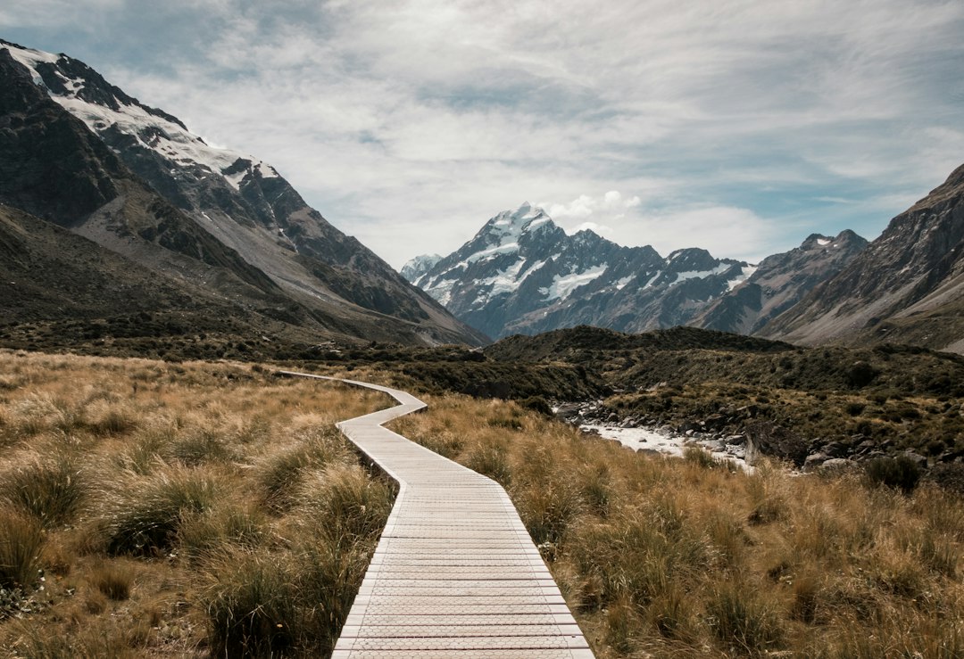
Heading further inland, the road to Mount Cook turns off at Twizel and runs toward the mountains across a flat, dry plain. The view ahead is the point: Aoraki sitting at the end of the valley like a wall, and the road heading straight for it. The Hooker Valley track, which starts at a car park near the visitor centre, takes visitors across three swing bridges and past a glacial lake to a viewpoint close enough to feel the scale of the mountain properly. It is a long, flat walk, and the wind at the far end has a way of making people turn their jackets up. The lake at the terminus often carries small icebergs calved from the glacier above, and the whole scene is one of those places where the photograph feels inevitable and also quietly inadequate.
On the other side of the mountains, the road through Arthur’s Pass is the kind of drive that requires stopping repeatedly. The pass itself is a high, exposed saddle with kea — the alpine parrot, olive-green and curious and well-known for dismantling car trim — loitering around the car parks. Kea are a real presence, not a bonus: a car left with a window open in the wrong place will occasionally be missing rubber seals. The forest on the western side of the pass is a dense, wet, moss-covered thing, completely different from the eastern beech forest, and the change happens over just a few minutes of driving.
Arthur’s Pass village is small, and the weather is the main event. A transport worker based at the top of the pass, who asked not to be named, said the road closes for snow more often than people expect, and the drivers who plan for it are the ones who don’t mind. Or something along those lines. The pass is a place where the weather and the road are in constant negotiation, and the photographs that come out of it tend to reflect that — dramatic, quickly changing, sometimes just cloudy.
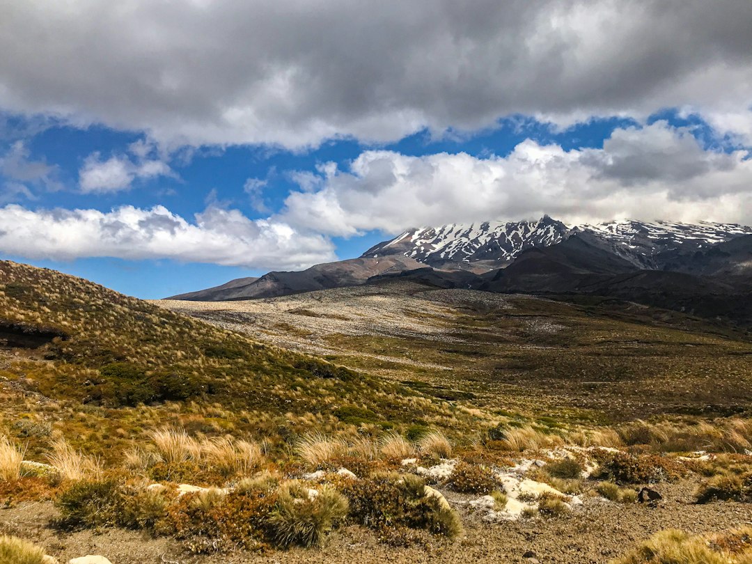
Heading north, the volcanic plateau around Tongariro is one of the country’s most distinctive photographic regions, and also one where the weather is in charge. The Tongariro Alpine Crossing is a full day of walking over active volcanic terrain, and the reward is a landscape of craters, steam vents, and the emerald-coloured lakes of the Emerald Lakes cluster. Photographers who time the crossing for late afternoon sometimes find the light doing exactly what the guidebooks promise. More often they find cloud, wind, and a walk that becomes a slog.
The trick, if there is one, is to be flexible. The area rewards a few days of patience over a single attempt, and nearby spots like Taranaki Falls and the Whakapapa ski area offer alternatives when the mountain is hidden. The mountain itself — Ruapehu, Ngauruhoe, Tongariro — is the kind of subject that changes with every hour.
Further east, the road out to the East Cape is genuinely remote. The coastline is one of the least-visited stretches of New Zealand, the settlements are small, and the views are of a kind that comes from having nothing between you and the Pacific except a few hills. The East Cape lighthouse sits at the end of a long, winding road and a walk up a steep hill, and the reward is a working lighthouse, a wild coastline, and almost no one else. The first light to hit mainland New Zealand in the morning arrives here. Photographers who make the drive out and stay in one of the small local accommodations come back with pictures of a coast that feels almost entirely empty.
Heading further north, the Northland coast has its own set of well-known subjects, and the Bay of Islands is the obvious one. The landscape around Russell and Paihia — the water, the islands, the bush — is a quieter kind of beautiful than the South Island’s drama, and the light on the water at dusk tends to be gentler. Further up the coast, Ninety Mile Beach and Cape Reinga are the kind of places that reward a long drive: the beach itself is a vast, flat stretch of sand that can be driven at low tide, and the cape is a place of strong wind and a lighthouse and a view of two oceans meeting, or at least of the tide races that mark the meeting point.
The driving itself is part of the appeal. A road trip through New Zealand is a long sequence of places where the car has to be pulled over, the door opened, and the camera lifted. The distances are real — the country is longer than it looks on a map, and driving between the highlights eats days — but the scenic pull-offs and the small towns and the roadside food are as much part of the experience as the well-known views. A meat pie from a bakery in a small town, eaten on a bench outside with the wind trying to take the paper bag, costs a few dollars and is one of the better parts of the day.
There is also the basic matter of how to photograph any of this. New Zealand’s light is bright and variable, and the country is often cloudy in ways that help or hinder depending on what’s wanted. A polarising filter earns its place in any kit, particularly on water and sky. A tripod is useful in low light and a liability in wind. A rain cover for the camera is less optional than it sounds. And the people who get the best results tend to be the ones willing to wait, to come back, and to accept that the view on any given day may not be the view they came for.
New Zealand’s most famous views are genuinely worth visiting; the country’s quieter stretches are often better photographs. The Catlins coast, the empty East Cape road, the moss forest on the west side of Arthur’s Pass — these are places where the land is not performing for anyone. A photograph from one of them feels like something found rather than something collected.
The road northeast out of the Catlins runs along the coast past a series of small beaches, and there is a stretch where the road is so close to the water that the spray hits the windscreen. The car slows without any conscious decision. The wipers go on. The view keeps changing.