Start at Tanjong Pagar, Where the Ghost Trains Still Wait
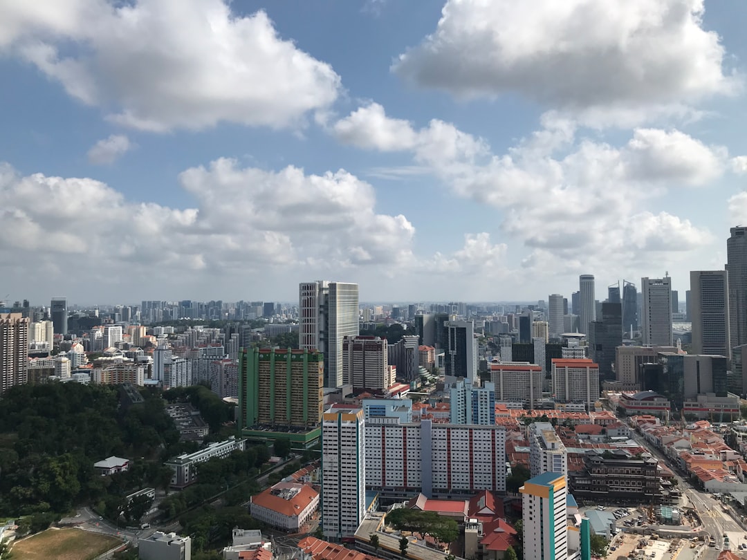
Tanjong Pagar Railway Station is a magnificent Art Deco monument from 1932, designed by British architects, with a soaring passenger hall that could double as a cathedral of travel. It’s a conservation building now, and you can walk right up to the platform where trains once departed for Kuala Lumpur. The tracks are gone, but the platform edge remains, and from here you’ll step onto the gravel path that cuts behind the station, past the old signal boxes and into a landscape that transitions from concrete to canopy within five hundred metres.
The Green Corridor is a 24-kilometre ribbon of abandoned railway line that slices through the heart of Singapore, hidden in plain sight beneath a canopy of wild lallang grass and rain trees. Most visitors and plenty of locals zip over it on the MRT or AYE without ever realising they’re crossing the spine of a former cross-border railway that once connected Singapore to Kuala Lumpur, Thailand, and beyond. The corridor follows the historic Keretapi Tanah Melayu (KTM) railway line, which ceased operations in 2011 when the railway land was returned to Singapore. What you’re walking today is the physical ghost of that line — the sleepers are gone, the tracks lifted, but the gravel bed remains, now softened by moss and mulch. The route runs from the old Tanjong Pagar Railway Station in the south, through the Bukit Timah area, all the way north to the Woodlands Train Checkpoint at the Causeway. It’s a walk that will take anywhere from four to seven hours, depending on pace and how often you stop. And you will stop.
Surreal Silence Along the MRT Tracks
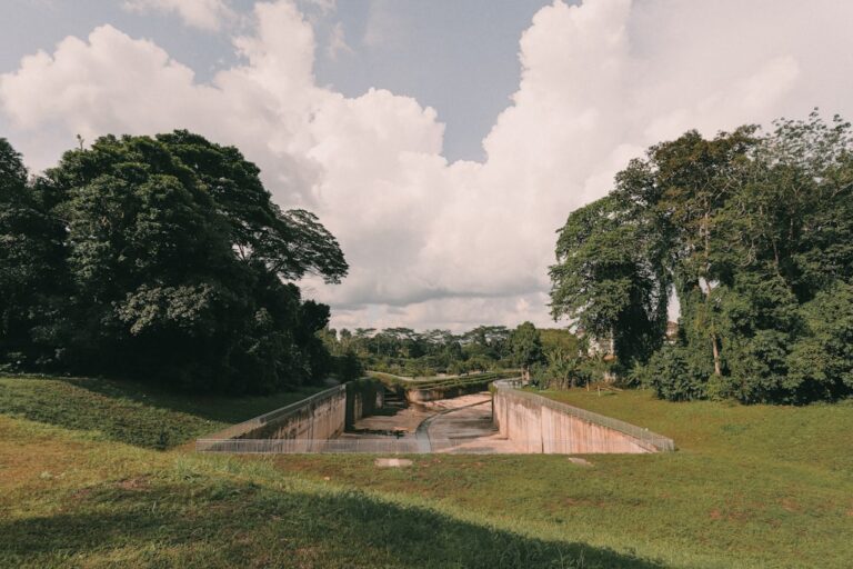
The first two kilometres are the most surreal. You’ll be walking alongside the elevated tracks of the East-West MRT line, the trains whirring past inches from your shoulder, while below, the path drops into a deep cutting lined with secondary forest. The air changes here: the scent of diesel and hot metal gives way to damp earth and the sweet rot of fallen frangipani blossoms. You’ll pass under the Tanjong Pagar viaduct, where the concrete arches are now covered in climbing ferns, and emerge onto a narrow pedestrian bridge that crosses the Ayer Rajah Expressway. Look down and you’ll see trucks hurtling toward the port; look ahead and the corridor stretches into a green tunnel that feels impossibly far from the city you know.
This is where most casual walkers turn back, but the real character begins once you cross into the Tanglin Halt area, where the corridor passes through what was once Singapore’s first public housing estate. The blocks here are from the 1960s, the kind with open corridors and spiral staircases, and the railway cutting runs directly alongside them. You’ll see residents hanging laundry on poles, old uncles fanning themselves on plastic chairs, and children playing on the grass verge that was once the railway embankment.
Drongos, Leafbirds, and the Common Hill Myna
Continue north, and the corridor widens into a secondary forest corridor that connects the Botanic Gardens to the Bukit Timah Nature Reserve. This is the most biodiverse stretch of the walk. Birdsong that sounds like it belongs in a rainforest — drongos, leafbirds, and the unmistakable call of the common hill myna. Keep your eyes on the ground, too: the gravel path is dotted with wild ginger, ferns, and the occasional patch of tapioca plants, remnants of the kampong gardens that once lined the railway. At certain points, the canopy closes overhead so completely that the only light is dappled, and the temperature drops by a good three degrees. It’s the closest thing to wilderness in central Singapore, and it’s only a few metres wide.
You’ll cross the Bukit Timah Road bridge at the former Bukit Timah Railway Station — a small, whitewashed building with a preserved signal cabin and a level crossing that still has its gates. The station was once the busiest along the line, serving the surrounding plantation estates and, later, the military bases in the area. Today it’s a visitor centre where you can fill your water bottle and use a proper toilet — a welcome luxury when you’re hours into a walk with no facilities ahead.
Swimming Pools Through the Foliage
Past Bukit Timah, the corridor enters a longer, more exposed stretch that runs alongside the Pan Island Expressway. This is the part that writers usually skip. It’s here that the corridor reveals its true character: a thin green lifeline squeezed between six lanes of traffic and the back fences of landed properties. Private swimming pools appear through gaps in the foliage; the hum of air conditioning units drifts over; and this narrow strip of abandoned infrastructure has become a haven for dragonflies, butterflies, and the occasional monitor lizard.
The section from King Albert Park to the Rail Corridor North entrance is where the corridor really opens up. The canopy recedes, and you’re walking through grassland that feels almost savannah-like in the afternoon heat. The gravel path is wider here, and the sun beats down directly. This part demands proper preparation: a hat, sunscreen, and at least two litres of water per person. There are no shops or shelters for the next six or seven kilometres. The reward is a sense of isolation rare in Singapore — you can walk for twenty minutes without seeing another person, and the only sounds are the wind in the lallang and the distant rumble of trains on the MRT.
A Concrete Milepost in the Verge
As you approach the northern end, the corridor passes through the Mandai area, where the railway once connected to the Johor line. The landscape is flatter, more industrial, with the heavy machinery of the Mandai depot visible to the west. But don’t rush. Remnants of the railway’s past appear in unexpected places: a concrete milepost embedded in the verge, a rusted signal arm half-buried in the soil, the foundations of a former staff quarters now overgrown with morning glory. These details are easy to overlook when focused on the finish line.
The final approach to the Woodlands border crossing is anticlimactic by design. The path terminates at the Woodlands Train Checkpoint, a utilitarian building that handles rail freight and, until 2011, passenger services to Johor Bahru. You can’t cross into Malaysia here — the checkpoint is closed to pedestrians — but you can stand at the gate and see the tracks that continue north across the Causeway, into Johor and beyond.
Reading the Railway with Your Feet
The Green Corridor is not a difficult hike, but it is demanding in terms of exposure and length. The surface is mostly compacted gravel with some sections of uneven earth and roots, so decent walking shoes are a non-negotiable. The path is also completely unshaded for long stretches, so early morning or late afternoon starts are best if you want to avoid the midday heat. A typical through-hike takes five to six hours, including breaks, and you’ll want to factor in time for photography — the light through the canopy in the late morning is particularly good.
What the corridor offers that no other Singapore walking trail can is a unique historical perspective. You are walking a route that was once a lifeline for the island’s economy, a conduit for the rubber, palm oil, and tin that made Singapore a global port. The railway was built by the British, operated by the Malayan Railway, and after decades of political wrangling, finally returned to Singapore in a land-swap agreement that few people remember today. The corridor itself is a palimpsest of that history, and every time you step over a railway sleeper left in place, or pass a signal post that still bears its original markings, you’re reading that history with your feet.
The corridor has also become a green corridor in a deeper sense, connecting the Bukit Timah Nature Reserve to the Central Catchment Nature Reserve and beyond. Researchers have documented somewhere around a hundred species of birds using the corridor, along with pangolins, otters, and the occasional wild boar. The vegetation has recolonised the gravel bed, creating a habitat that is both artificial and unexpectedly rich. Nature doesn’t need much — just a gap in the concrete, a pause in the development, and time.
The Light at the Curve
For the full experience, consider breaking the hike into two halves. Start at Tanjong Pagar in the morning, walk to the Bukit Timah station (about nine kilometres), and reward yourself with a meal at one of the nearby eateries on Upper Bukit Timah Road. Then return on another day to tackle the northern section from Bukit Timah to Woodlands, which is a different character altogether — wilder, more exposed, and more contemplative.
There’s a particular moment on the northern stretch to watch for, about halfway between the Bukit Timah station and the Rail Corridor North entrance. The path curves slightly to the west, and for a few hundred metres, you’re walking directly towards the Central Catchment Nature Reserve. The canopy opens, and you can see the forested hills of MacRitchie in the distance. If it’s late afternoon, the light will be golden, and the corridor will feel like a secret passage into another time. That’s the moment most people miss, because they’re looking at their phones, checking their pace, or thinking about lunch. Pause. Listen to the cicadas.
The Green Corridor is not a pristine wilderness, nor is it a carefully curated park. It’s a rough, raw slice of Singapore that most official guides sanitise out of existence. The railway sleepers are still embedded in the earth, and the only way to truly understand it is to put one foot in front of the other and walk.
📷 Photos: Peter Leong (Unsplash)