Following the Abandoned Military Trails on Coloane Island to a Forgotten Fort
Following the Abandoned Military Trails on Coloane Island to a Forgotten Fort
You wouldn’t expect a forgotten fort to be hiding in plain sight on a bustling Chinese enclave, yet here you are, pushing through a tangle of lantana and wild hibiscus on Coloane Island, the quietest of Macau’s three territories. The trail underfoot is barely two feet wide, a ghost of a path paved with crumbling concrete and strewn with decades of fallen leaves. Above you, the canopy of banyan and acacia trees filters the subtropical sun into dappled light, and the only sound is the crunch of your boots and the distant, muffled thrum of the South China Sea. This isn’t the Macau of neon-lit casinos and throngs of tourists; this is the Macau that time forgot, and you’ve come to find its secrets.
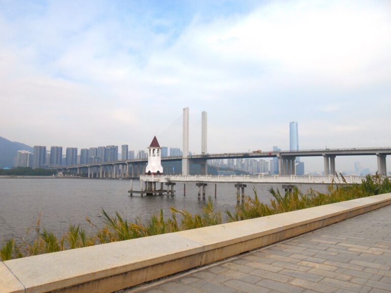
The trail you’ve chosen is one of several abandoned military roads that spiderweb across the island’s undeveloped hills. Built by the Portuguese military in the late 19th and early 20th centuries, these paths once connected a network of coastal batteries, observation posts, and fortified barracks designed to defend the colony from an improbable naval invasion. Today, they are forgotten arteries, reclaimed by forest and silence. A good place to start is the trailhead near the Hac Sa Reservoir, where a discreet break in the chain-link fence marks the threshold. From here, your journey begins in earnest, climbing gently through dense secondary forest.
Lantana, Wild Hibiscus, and an Old Telegraph Line
The path is unmistakably military: straight, functional, and built to last. Original stone retaining walls, now half-swallowed by moss and fern, and the occasional concrete drainage channel still divert rainwater into the gully below. Rusted iron posts that once supported a telegraph line stand with their porcelain insulators intact. The gradient is steady but manageable—a good 20-minute climb that gets your blood moving without leaving you winded. At one point, the trail opens onto a small plateau with a partial view of the reservoir, its dark green water mirroring the sky. The birds are louder than you’d expect: bulbuls, magpie-robins, and the occasional drongo, their calls echoing through the trees.
Then, the path narrows again, and the vegetation closes in. For a few hundred meters, you’re walking through a tunnel of green, the leaves brushing your shoulders and arms. It’s easy to imagine a Portuguese sentry making this same walk a century ago, rifle slung over his shoulder, scanning the undergrowth for any sign of trouble. The air is thick and humid, even in the cooler months, and the light breeze that occasionally stirs the canopy is welcome. Keep your eyes peeled for the turnoff to the fort itself—it’s marked by a small, weathered concrete post about waist-high, almost invisible unless you’re looking for it. If you miss it, you’ll find yourself continuing along the ridge toward a modern telecommunications tower, which is also worth a detour for its panoramic views of the Cotai strip and the sprawling casinos of Taipa.
A Clenched Fist in the Hillside
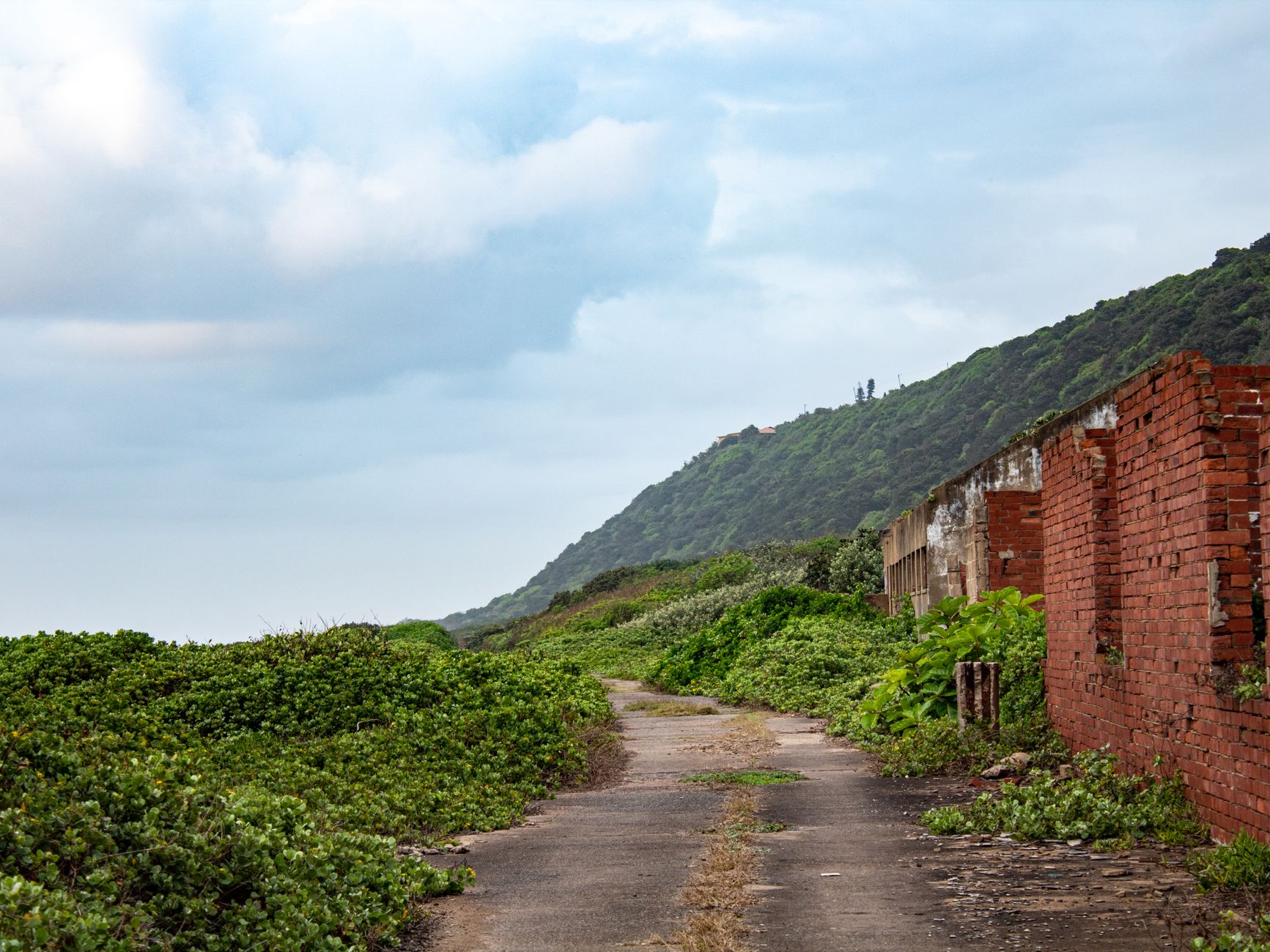
The fort, when you finally reach it, is not a grand structure. It’s a squat, rectangular battery of reinforced concrete, about the size of a two-car garage, set back into the hillside like a clenched fist. The roof is covered in a thick carpet of moss and small succulents, and the entrance—a low, arched doorway—is partially blocked by a fallen branch. Duck inside, and the temperature drops noticeably. The interior is a single chamber, about 20 feet by 15, with a concrete floor scarred by decades of weathering. Light filters in through narrow slits in the walls—the original gun ports—and you can see the remnants of metal mounting brackets where artillery pieces once stood.
The walls are covered in graffiti, but not the kind you might expect. While there are a few modern tags from adventurous hikers, most of the markings are old: dates from the 1950s and 1960s, names in Chinese characters and Portuguese script, and even a faded carving of a sailing ship. The best time to visit is late afternoon, when the sun slants through the gun ports and illuminates the dust motes dancing in the air. You can stand at one of the slits and look out over the sea, imagining the view as it was a century ago: no high-rises, no bridges, just the endless blue of the ocean and the distant silhouette of the Pearl River Delta.
The Secondary Observation Post
From the main fort, a faint trail continues eastward along the ridge, connecting to a smaller battery that once served as a secondary observation post. This second structure is even more ruinous than the first—the roof has partially collapsed, and you’ll want to tread carefully among the fallen concrete. But the effort is rewarded with the best view on the entire hike: a sweeping panorama of the Hac Sa beach below, the jet-black sand contrasting with the turquoise water, and the offshore islands of Hengqin in China to the north. You can see the waves breaking on the shoreline, and on a clear day, the faint outlines of the bridge to Taipa.
This section of the trail demands a little more care. The path is less distinct here, and you’ll need to watch your footing on loose rocks and exposed roots. But the solitude is profound—you’re unlikely to encounter another soul on this stretch. The only sign of the 21st century is the occasional distant roar of a jet taking off from Macau International Airport, a reminder that you’re not as far from civilization as you might feel.
Down Through Bamboo and Rubble
The loop trail descends through a different kind of forest on its way back toward the reservoir. The vegetation changes subtly—more bamboo here, and the dappled light gives way to deeper shade. The ruins of a small guardhouse, its walls reduced to rubble, and a rusted water tank half-buried in the undergrowth appear along the path. The trail here is wider and better-maintained, as it’s occasionally used by local walkers, but it still retains that sense of hidden discovery. Small white markers painted on rocks and trees by a local hiking group help with navigation, though the trail is generally easy to follow.
As you near the reservoir, the sounds of the city begin to filter back in: the hum of traffic, the distant sound of a construction site, the barking of a dog. The hike is not long—about 4.5 kilometers in total, taking two to three hours at a relaxed pace—but it feels like a journey into another world.
Practical Considerations for Your Hike
Plan logistics carefully. The trail is best done in the dry season (October to April), when the path is less muddy and the heat is more bearable. Start early in the morning to avoid the midday sun and to allow time for exploring. Bring at least one liter of water per person, a sun hat, insect repellent (the mosquitoes can be fierce in the forest), and sturdy shoes with good grip—the concrete is slippery where moss has taken hold. A headlamp is a good idea, even for a daytime hike, as the interior of the fort is dark and you’ll want to examine the graffiti and gun ports without straining your eyes.
There are no facilities on the trail—no water fountains, no restrooms, no shops—so come prepared. The nearest convenience store is at Hac Sa beach, about a 15-minute walk from the trailhead, where you can also find restrooms and a small cafe. If you’re coming from Macau’s city center, a taxi from the ferry terminal to Hac Sa takes about 25 minutes and costs around 150 patacas (roughly US$19). You could also take public bus route 21A or 25 from the terminal, which drops you at the Hac Sa Reservoir stop.
The forgotten fort on Coloane Island is not a major tourist attraction, and that’s precisely its charm. It’s a quiet, intimate place where you can step away from the glitter and noise of modern Macau and connect with a layer of history that most visitors never see. The trail will test your legs a little. So lace up your boots, grab a bottle of water, and follow the abandoned roads into the forest. The fort is waiting, its concrete still warm from the afternoon sun.

📷 Photos: Luka Fernandes (Pexels), Spyros Asimakopoulos (Pexels)