The key fob clicked. Nothing happened. We pressed it again, harder, standing in the rental lot on the outskirts of Christchurch as a cold wind came over the Port Hills. The door stayed shut. A woman named Renata, who handled handovers for the campervan company, walked over and jiggled the handle with the flat of her palm. “It’s the cold,” she said, not quite an apology. “The batteries don’t like it when the vans sit overnight.” She pried the fob open, swapped in a fresh cell, and the lock popped. By the time we’d stowed the bags and figured out which lever adjusted the passenger seat, the whole thing felt less like a problem and more like a first lesson: New Zealand’s South Island wasn’t going to cooperate with assumptions.
Christchurch itself felt like a city still deciding what it wanted to be. We drove through the centre on the way out, past the cardboard cathedral and the redeveloped riverbank. The Avon looked green and slow, and a few people were punting on it, pushing flat-bottomed boats with long poles in a scene that felt transported from Oxford. But then we turned a corner and passed a block of vacant lots where buildings had been demolished after the 2011 earthquake and never rebuilt. The city had patched itself up unevenly, some parts polished and some still raw. We didn’t linger. The plan was always to head toward Banks Peninsula by midafternoon, and the road demanded attention — narrow, winding, rising through pine forest before dropping into views of Lyttelton Harbour.
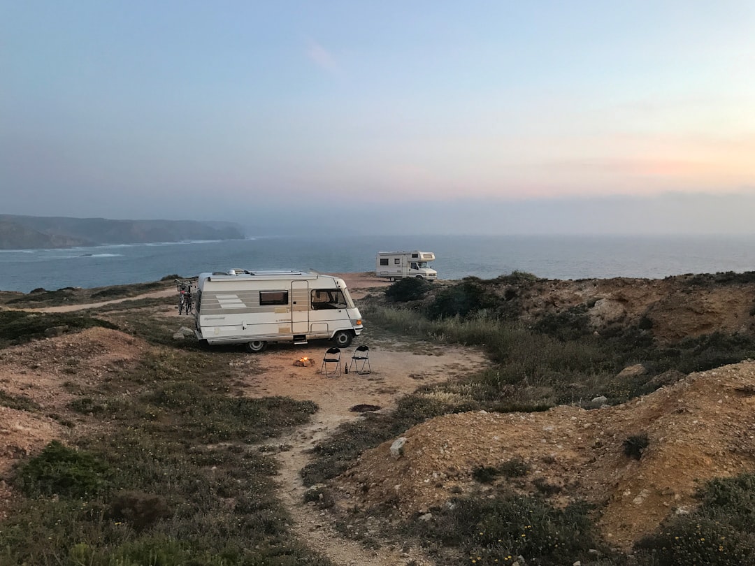
Banks Peninsula is not what most people picture when they think of the South Island. There’s no alpine drama here. Instead, the hills roll green and rounded, and the bays tuck into the coast like folded fabric. We parked the van at a DOC campground above Akaroa, a French-settled town that feels smaller and quieter than its reputation suggests. The campsite had a cold tap and a long-drop toilet, and the wind was strong enough that we cooked dinner hunched behind the van, using the body as a windbreak. The sausages took longer than expected. The instant mash went lumpy. It wasn’t a good meal, but it was the first meal.
By morning, the wind had dropped. We drove back through Christchurch without stopping, heading inland on State Highway 79, and the landscape changed quickly. The flat farmland gave way to rolling foothills, and then the mountains appeared — not gradually, but as a wall that seemed to rise out of the middle distance as we crested a rise near Geraldine. The light shifted. The sky went that particular shade of pale blue that high-altitude places get when there’s no moisture in the air. Lake Tekapo arrived around midday, and it was bluer than any photograph had suggested. Not turquoise exactly, but something closer to the color of a glacier melt that has ground rock flour into suspension — a milky, opaque teal that doesn’t look real until you’re standing next to it.
The Church of the Good Shepherd sits on the lakeshore, a small stone building with a single window framing the water. It was busier than we’d expected — a dozen people lined up for photos, and a wedding party was setting up near the carpark. We walked past it, down to the shoreline, where the water lapped at a beach of rounded grey stones. A woman was skipping them. A couple was trying to take a selfie with the church in the background and failing. It’s the kind of spot where everyone is trying to capture the same image, and the real thing is better than any of them. We didn’t take many photos. We sat on a rock and watched the light change as clouds passed overhead.
The town of Tekapo itself is small — a few streets of motels, a supermarket, a couple of cafes. We bought supplies for the next few days and parked the van at the Lake Tekapo Motels & Holiday Park, which had hot showers and a kitchen block that smelled of fried onions and damp towels. The Dark Sky Reserve is the main draw here, and as dusk settled, we drove a few kilometers out of town to a pull-off with no streetlights. The stars came up slowly, then all at once. The Milky Way was visible as a distinct band, not a suggestion. A satellite moved across the field of view, steady and dim. We stayed until our feet went numb, then retreated to the van and ran the heater until the windows fogged.
Day three took us deeper into the Mackenzie Basin, past the salmon farms at the base of the canal and onto the road toward Mount Cook Village. The highway runs straight for long stretches, then curves into valleys that narrow as they climb. The village itself is tiny — a hotel, a visitor center, a few staff cottages, and not much else. The DOC campsite at White Horse Hill sits at the trailhead for the Hooker Valley Track, and we parked under a stand of mountain beech trees that rattled in the wind.
The Hooker Valley Track is often described as one of the best day walks in New Zealand, and that reputation is earned. It’s three hours return, mostly flat, crossing three swing bridges and passing through alpine scrub before opening onto the terminal face of the Hooker Glacier. The trail was busy even on a Tuesday — we passed families with small children, groups of European hikers with expensive gear, a man jogging in trail runners and shorts. At the end, the lake was dotted with icebergs that had calved from the glacier, small and sculptural, floating in water the color of weak tea. We sat on a bench near the shelter and ate a sandwich that had been crushed in our pack. The icebergs cracked and shifted, making sounds like breaking glass.
A mistake was made here, and it cost us. We’d assumed the village store would have a reasonable selection, but it’s small and priced for the captive market — a loaf of bread was nine dollars, a block of cheese something similar. We’d passed a supermarket in Twizel an hour earlier and hadn’t stopped. The dinner that night was overcooked pasta with a jar of sauce that tasted mostly of sugar. It was the kind of meal you eat quickly and try not to think about. The wind picked up again overnight, rocking the van hard enough that sleep came in fragments.
Morning brought clear skies and a view of Aoraki/Mount Cook that was so clean it almost looked artificial. The mountain sits at the head of the valley, a wedge of rock and ice that dominates the horizon. We drove out without stopping, heading south on the road to Wanaka, and the landscape softened again. The Lindis Pass was green and bare, with tussock grass bending in the wind. By lunch, we were parked at a lakeside spot near the outskirts of Wanaka, eating the same crushed sandwich with slightly better bread bought from a Four Square.
Wanaka is a town that knows how good it has it. The lake is clear and wide, with mountains rising directly from the far shore. The main street is full of outdoor gear shops, ice cream parlors, and real estate agencies — a prosperous, active kind of place that feels like Queenstown’s quieter cousin. Roy’s Peak is the draw for the active set, and we’d read the warnings: steep, exposed, five to six hours return, no shade. We started at 6:30 AM, earlier than we’d planned, and the track climbed immediately. The first hour was a grind through private farmland, switchbacks through yellow grass and sheep paddocks. A mist hung in the valley below, then burned off as we gained elevation. The view from the summit ridge is exactly as advertised — a long, thin spine of rock with the lake below and mountains in every direction — but the surprise was the wind. It was strong enough that we had to brace against it to stand upright. We ate a muesli bar, took a photo that would look identical to everyone else’s, and started down. The descent was harder on the knees than the ascent, and by the time we reached the carpark, our legs were done.
That Wanaka Tree — the one that grows out of the lake, photographed a million times — sits near the edge of town, accessible by a short walk along the waterfront. We passed it in the late afternoon, when the light was golden and the tourists were three deep on the shore. A Chinese couple was directing each other into poses. A man with a tripod was waiting for the ripples to settle. The tree itself, a twisted willow, looked smaller than expected. It’s iconic, but it’s also just a tree. We watched for a few minutes, then walked back to the van and drove to a campground on the outskirts of town, where the only sounds were the hum of the van’s fridge and a distant dog barking.
Queenstown, on day five, felt like arriving at a party that had been going on for a while. The town was busy — bungee jumpers screaming off the Kawarau Bridge, jet boats carving figure-eights on the Shotover River, tour buses disgorging passengers on the lakefront. We parked the van in a lot near the Skyline Gondola and took the ride up, mostly for the view. The cable car lifts you above the town, and from the top, Lake Wakatipu stretches south, long and narrow, with the Remarkables range rising to the east. The observation deck was crowded, so we bought a beer and sat on a bench facing the lake, watching a paraglider spiral down toward the golf course.
The lake cruise we’d booked was a late addition, a two-hour circuit on a small boat that hugged the shoreline. The guide pointed out the places where the Earnslaw, the historic steamship, had run aground in low water, and told a story about a farmer who’d rowed out to rescue the passengers. Most of it was forgettable, but the light at sunset turned the water pink, and for a few minutes, the tour group was quiet.
We’d come from Christchurch through Tekapo and Mount Cook, over the passes and down the valleys, in a van that had cost a thousand dollars to rent and maybe a hundred in diesel. We’d eaten bad pasta and good sandwiches, frozen at a dark-sky reserve and been wind-blasted on a ridge. The van had not broken down. The battery had not died again. Everything had gone mostly according to plan, which is itself a kind of luck that seasoned visitors learn not to take for granted.

📷 Photos: Peter Schulz (Unsplash), Peter Schulz (Unsplash)