Alps to Adventure: A South Island Campervan Arc: Day 2
By the time we rolled the campervan out of Christchurch on day two, the rental company’s orientation video was already a fading memory — something about grey water and the correct way to level the vehicle on uneven ground, none of which applied yet. The odometer showed we’d covered barely seventy kilometers the afternoon before, mostly in stop-start traffic finding a supermarket and then a parking spot that wasn’t too far from the city center. Morning had come cold and damp, the kind of South Island dawn that makes you check whether the heater actually works before you commit to getting out of bed. (It did, barely, on the lowest setting.)
The standard route out of Christchurch toward the Southern Alps runs through Darfield and then curls up toward Arthur’s Pass, and that’s what most people drive. It’s also what every campervan rental company recommends, what the tourism websites describe, and what the GPS calculates automatically when you type in any destination on the West Coast. We’d read enough forum posts to know there was an alternative — the Inland Scenic Route 72 — but forums are full of people who describe a fifteen-minute detour as if it changed their lives. The skepticism was mutual as we pulled onto the highway.
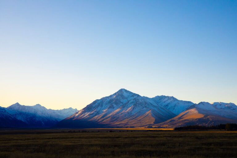
Three things happened in the first hour that made us reconsider whether the standard route was actually bad advice. First, the sky cleared just past Rolleston, not dramatically but steadily. Second, we passed a paddock full of what we initially thought were sheep until one lifted its head and revealed itself as an alpaca — then three more, then a dozen, all watching the van with the particular stillness of animals that have decided they are not impressed. Third, the road climbed through a series of gentle bends toward the foothills, and the mountains appeared not as a distant postcard but as a wall that seemed to grow taller with every kilometer, as if we were driving toward an event rather than a destination.
The Inland Scenic Route splits off State Highway 1 just south of Rakaia, and the turn is easy to miss. There’s no archway, no visitor center, no sign that says “this is the better road.” It’s just a left-hand turn onto a two-lane road that runs parallel to the mountains rather than heading straight for them. We nearly drove past it, braking late and earning a brief flash of the high beams from the car behind. A farmer in a ute, probably heading home, probably not in a hurry. The road surface changed almost immediately from smooth seal to something older and patched in places.
The first settlement of any size on this route is Methven, and we had no plans to stop there. Methven is a ski town in winter and a quiet farming service center the rest of the year, and most campervan itineraries skip it entirely in favor of pushing through to the national park. We stopped because the diesel light came on earlier than expected — a miscalculation, not a plan — and the only station for the next eighty kilometers sat at the edge of town, opposite a bakery that smelled like it had been baking since before we woke up. The pie we bought there, twenty minutes later, was better than anything we’d eat for the rest of the trip. Mince and cheese, but the mince had actual texture, actual flavor, not the gray paste that passes for meat in most highway bakeries. The woman behind the counter said she’d been working there for nineteen years and had never once driven the full length of the scenic route. “I keep meaning to,” she said, wiping the counter. “One day. Or something.”
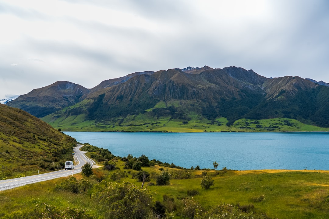
Beyond Methven, the road narrows and the traffic thins to almost nothing. For long stretches, we saw no other vehicles at all — just the van’s own reflection in the odd passing sign and the mountains drawing closer on the left. The Rakaia River runs alongside this section, wide and braided and the color of melted glacier, and there are dozens of unmarked pull-offs where you can stop and watch it without another soul in sight. Most of them are just gravel patches big enough for one vehicle, and most of them are littered with the remains of someone else’s picnic — a crushed can, a torn bag, the sad evidence that not everyone who stops here treats it with the same reverence. We found one that was clean and sat on the tailgate for twenty minutes with instant coffee from the van’s kettle, the water still hot enough to burn the tongue. The river sound was louder than we expected, a constant grinding of stones beneath the current, and the wind came in gusts that made us grateful for jackets we’d nearly left behind in Christchurch.
The section between the Rakaia River bridge and the turnoff toward Mount Somers is where the route earns its reputation. The road rises in a series of long, lazy gradients, and the landscape changes entirely. The farmland gives way to tussock-covered hills, then to scree slopes, then to the first stands of mountain beech forest. The van labored slightly on the steeper sections, the automatic transmission hunting for the right gear in a way that suggested we should have paid more attention to the rental agent’s advice about engine braking. A smaller, more powerful vehicle would have handled it without effort. The campervan, with its full tank of diesel and two people’s worth of camping gear, made its displeasure known in a low mechanical whine that we learned to ignore by the third hill. You learn to ignore a lot of things out here.
Mount Somers itself is a village so small it barely registers on the map — a general store, a handful of houses, and a DOC campground that fills up faster than anyone seems willing to admit. We’d reserved a spot online the night before, a precaution that felt excessive at the time but turned out to be essential. Every site was taken by late afternoon, and we watched three separate vans arrive, circle the loop, and leave again, their occupants’ faces shifting from hope to resignation in the space of a single slow lap. The camp host, a man named Stuart who wore the same thick fleece regardless of temperature, told us that the reservation system had only been in place for two seasons and that it had changed everything. “Used to be first come, first served,” he said, gesturing at the full campground. “Now people actually plan. It’s better, but it’s also — different.”
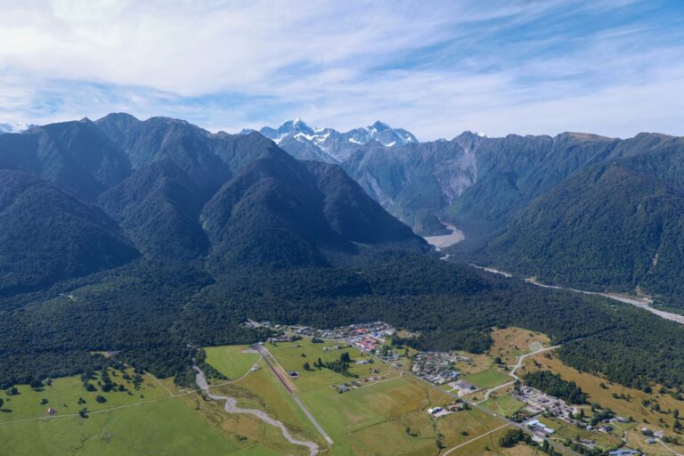
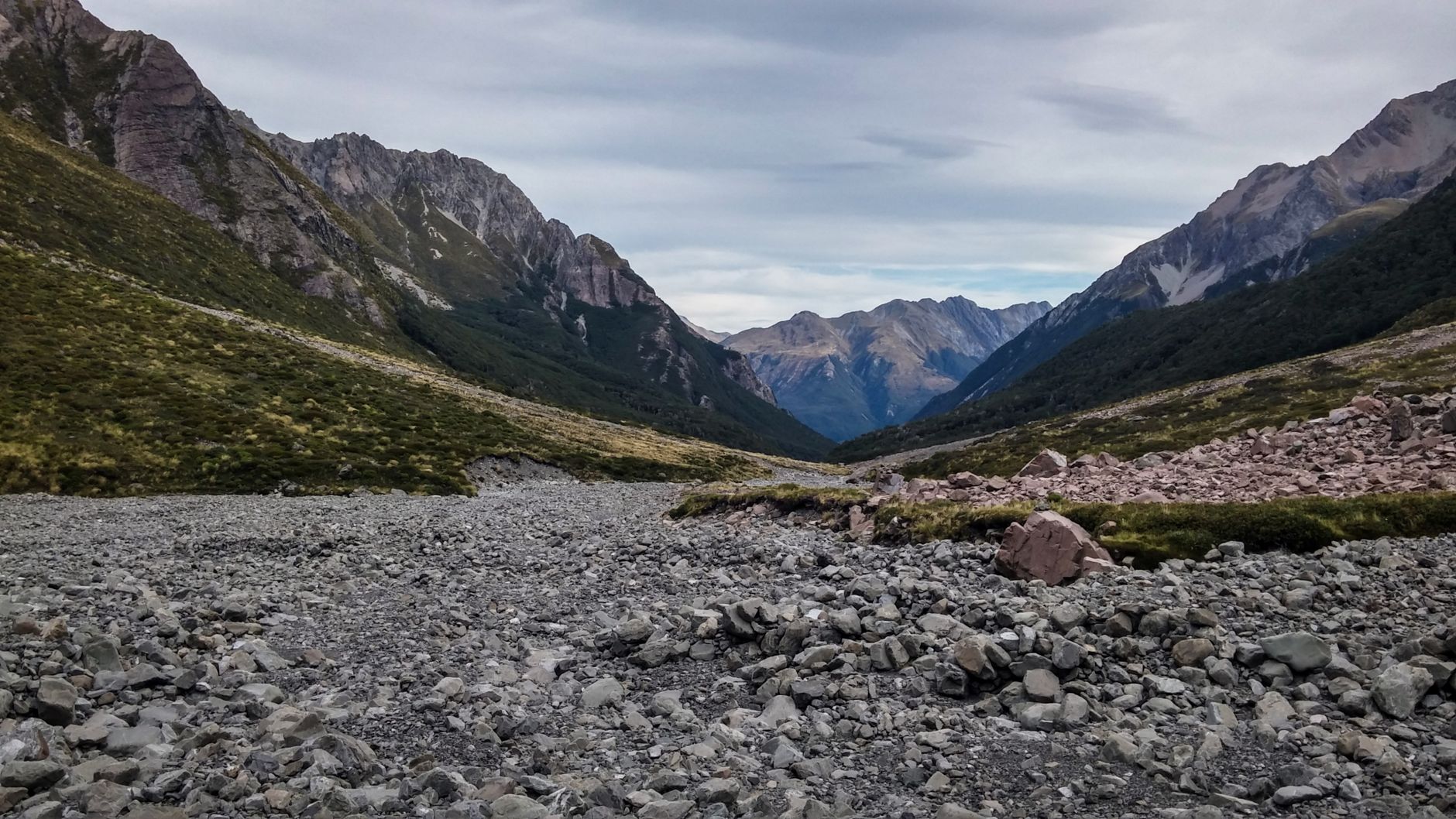
The campground sits at the base of the Mount Somers Track, a multi-day hiking route that connects to the larger St James Walkway, and the DOC hut at the trailhead was full of trampers who had come down from the tops that afternoon. They were the kind of hikers who carry lightweight stoves and dehydrated meals and talk about elevation gain the way other people talk about commute times. We had none of that gear and no intention of attempting the full track, but the short walk to the first viewpoint — an hour each way, described as “moderate” on the DOC sign — seemed like a reasonable afternoon activity. It was not moderate. The track climbed steeply through beech forest, then across an open scree slope where the path disappeared entirely and we had to follow cairns that seemed placed by someone with a different sense of direction. Forty minutes in, we stopped on a rock outcrop and looked back at the campground, which had shrunk to a cluster of colored dots in the valley below. The wind up here was stronger and colder, and we hadn’t brought enough layers. The smart decision would have been to turn around. We kept going, partly out of stubbornness and partly because the view from the top — when we finally reached it — made the whole thing worth the bad decisions that got us there.
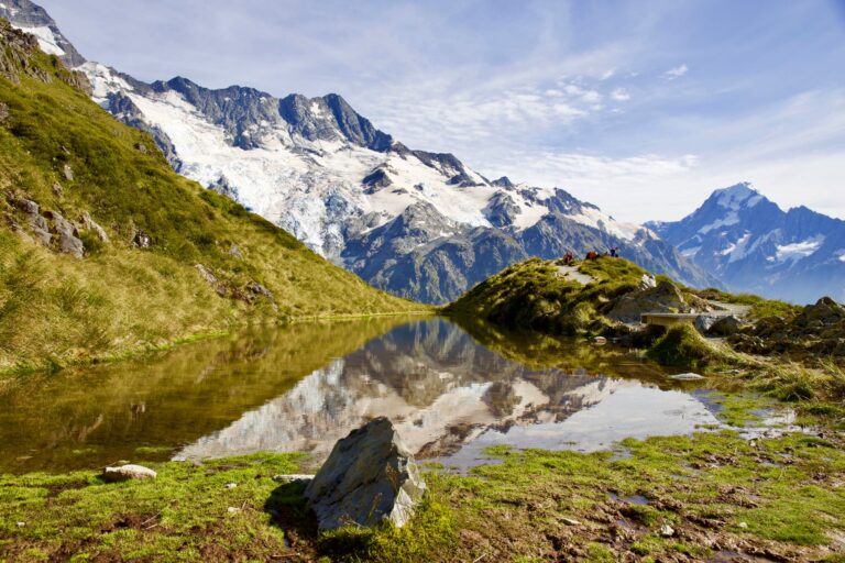
The viewpoint looks east across the Canterbury Plains toward the Pacific, and west into the heart of the Southern Alps, and the scale of it is impossible to capture in a photograph. The camera flattens everything, compresses the distance between the foreground ridge and the far mountains into something that looks like a backdrop in a theater. The real thing has depth, movement, a constant shifting of light and shadow as clouds pass overhead. We sat there for longer than we planned, the cold seeping through our jackets, and watched a pair of kea — those absurdly confident alpine parrots — land on a nearby rock and regard us with the casual arrogance of creatures who know they are protected by law. One of them hopped closer, inspected the zipper pull on my jacket with its beak, and then lost interest entirely, launching itself off the cliff edge in a single motion. The silence that followed was the loudest thing we heard all day.
Dinner that night was a compromise between ambition and the reality of campervan cooking. We’d bought fresh vegetables in Christchurch with grand plans for a stir-fry, but the gas burner in the van was slow and the wind outside made it nearly impossible to keep the flame steady. We ate pasta with jarred sauce and a bag of salad that had wilted slightly in the cooler, sitting on the van’s pull-out table with the door slid open to watch the last light leave the mountains. The other campers had mostly retreated to their own vehicles by then, their windows glowing yellow against the deepening blue of the sky. Someone a few sites over was playing acoustic guitar, badly, and someone else was laughing at it, and the sound carried across the campground in a way that made the whole scene feel more real than any of the staged photographs we’d seen online.
We did one thing wrong that day, and it cost us. We’d assumed the gas bottle in the van would last for at least two full days of cooking, based on nothing more than a vague sense that “campervans come with full tanks.” It ran out just as we were about to boil water for tea, the flame sputtering and dying with a finality that felt personal. No backup stove, no spare gas canister, no way to make hot water until we found a gas station that refilled bottles the next morning. We drank cold water and went to bed early, lying in the dark and listening to the wind move through the beech trees, the campervan creaking around us like a ship at anchor.
We woke the next morning to frost on the windshield and the smell of someone else’s cooking fire. The mountains were sharper in the early light, their edges defined by shadow, and the sky was a blue so clear it looked artificial. The gas bottle was still empty, the cold water still cold, and we had another three hours of driving ahead before we reached the West Coast. The second day had ended in the dark, with a cold drink and an early bed, and the third day was starting the same way. It was the kind of sequence that would bother someone who expected every part of a road trip to feel like a highlight reel. For us, it felt like the shape of something real.
📷 Photos: JinHui CHEN (Unsplash), Baptiste Valthier (Pexels)