Christchurch to Aoraki/Mount Cook: Mackenzie Basin & Southern Alps Campervan: Day 2
The bridge over the Tekapo Canal was narrow, single-lane, and we were stalled halfway across. Not because of another vehicle, but because a sheepdog was sitting in the middle of the road, panting, entirely unconcerned. The farmer behind us, visible in the side mirror, waved a hand from his ute window — not in apology, but as if to say this is normal, just wait. We waited. The dog eventually stood, stretched, and trotted off toward a cluster of sheep on the shoulder, and then we crossed. That was maybe ten minutes from the turnoff onto State Highway 8, on what was supposed to be a straightforward stretch between Lake Tekapo and Twizel.
The morning had started differently. We woke at a holiday park on the outskirts of Geraldine, the van’s windows fogged with condensation from two people breathing in a small space overnight. The propane heater had run out around 4 a.m., and we’d learned, by feel, that the van’s insulation was enough for autumn but not for the kind of cold that creeps into a mattress from below. The kettle boiled slowly. We ate muesli with UHT milk, standing outside because the interior still smelled of last night’s curry, and watched a man three sites over hose down a campervan that looked twice the size of ours. He had a system: rinse, soap, rinse again, then a chamois dry. It took him twenty minutes. We had no system.
The drive from Geraldine to the Mackenzie Basin is a gradual ascent, not a dramatic climb. The landscape shifts from green paddocks and shelterbelts of pine into something browner, wider, more exposed. By the time we passed the Fairlie turnoff, the sky had gone from grey to a pale, rinsed-out blue, and the mountains were visible as a distant line, not yet distinct. The road was almost empty. A single logging truck came the other way, and then nothing for long stretches.
We stopped at the Lake Tekapo township mostly because we needed to fill the van’s fresh water tank and because the supermarket there has a reputation among campervan forums for having a good deli counter. The reputation is accurate. We bought a block of smoked cheddar, some crackers, two apples, and a bag of liquorice. The woman at the checkout asked where we were heading and, when we said Aoraki/Mount Cook, nodded as if this made perfect sense. “Everyone’s doing that,” she said, not unkindly. “The carpark at the Hooker Valley track fills up by nine.” It was nearly ten-thirty.
The Tekapo Canal is not in the guidebooks, not prominently. It’s a straight artificial channel, built for hydroelectric generation, running parallel to the road between Tekapo and the Pukaki junction. The water is the colour of milky jade, opaque and smooth, and the canal has a service road beside it that is technically open to the public. We pulled over on a gravel patch near an access gate, walked to the edge, and stood there for longer than expected. The water moves with a surprising force, a steady, silent current. Two cyclists passed on the service road, then one more, all of them serious-looking, riding toward Twizel. The sheepdog incident happened maybe a kilometre further on, and after that, we saw a sign for the Tekapo-Waireka Canal walking track and considered it, but the day was already half-gone and we hadn’t eaten lunch yet.
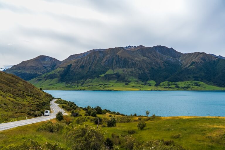
We ate lunch at a picnic table on the shores of Lake Pukaki, which is one of the more arresting bodies of water in the country. The lake is fed by glacial melt, and the colour — a suspended-silt blue — doesn’t look real until you’ve seen it. A truck carrying a load of hay bales was parked nearby, the driver asleep in the cab with a hat pulled over his face. We sat and ate our crackers and cheddar and watched a small inflatable boat being launched at a ramp further along the shore. Two men, both in waders, one carrying a fishing rod. The wind had picked up and the lake was flecked with whitecaps, and the boat looked too small for the conditions, but they went out anyway.
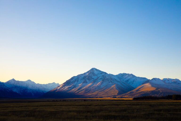
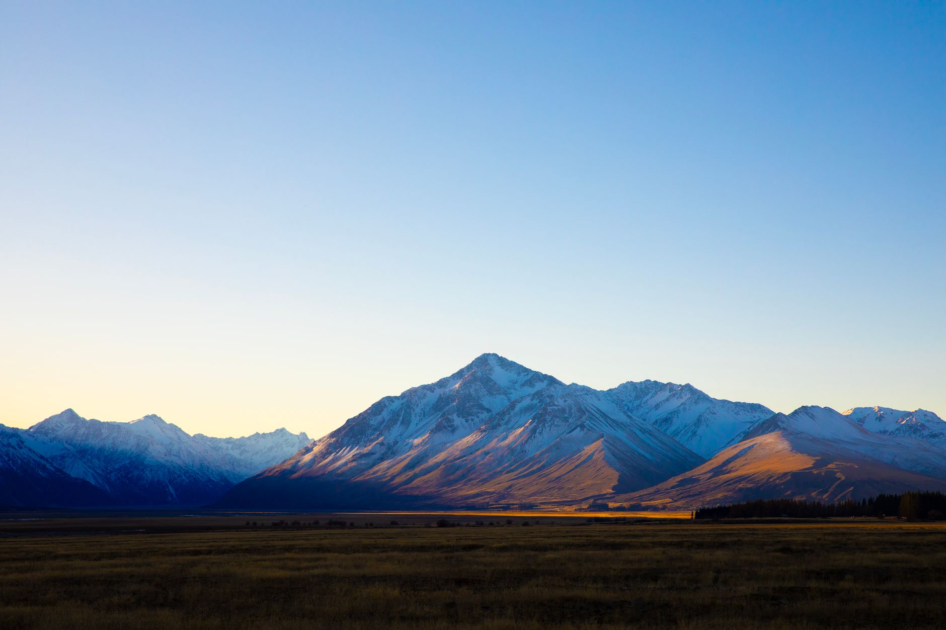
The road from the Pukaki lookout to Mount Cook Village runs alongside the lake, then turns inland through the valley of the Tasman River. This is where the landscape changes scale. The mountains on either side are not yet the highest in the Southern Alps, but they are close enough that the road feels enclosed, a ribbon of tarmac through a braided riverbed of grey stone and low scrub. The wind was stronger here, buffeting the van, and we had to slow down to keep the steering steady. A sign warned of falling rocks, and another said Next Fuel 160km, which we didn’t need but noted anyway.
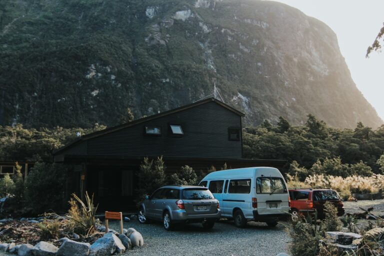
The village itself is not a village in any ordinary sense. It’s a cluster of buildings — a visitor centre, a hotel, a small motel complex, a few staff accommodation blocks, and a Department of Conservation office — arranged at the foot of the mountain. We parked the van in the designated campervan area near the White Horse Hill campground, and the view from the windscreen was of the Sefton and Cook peaks, both of them partly shrouded in cloud that was moving fast enough to suggest the weather could change at any moment.
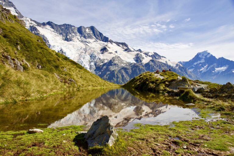
The Hooker Valley track begins from the same carpark, and the carpark was, as predicted, nearly full. We walked it anyway, because that was the whole point. The track is three hours return, mostly flat, with three suspension bridges that bounce and sway underfoot. The first bridge crosses the Hooker River, which is wide and braided and the colour of grey slate. The second crosses a smaller tributary, and the third spans a gorge below the terminal face of the Hooker Glacier. The terminal lake at the end is filled with icebergs — small, tabletop chunks of ice that bob in the water and make a cracking sound as they melt. We sat on a rock at the edge and watched a piece of ice calve off the main face of the glacier, a sound like a broken branch in the still air. A German couple next to us were taking turns photographing each other with the icebergs behind them, and the woman asked if we could take a picture of them together, which we did, and then they offered to take one of us, which we declined.
On the walk back, the weather did change. A front moved in from the west, and within twenty minutes the temperature dropped noticeably, and a light rain began. We had jackets in the van but not on the trail, and by the time we reached the second suspension bridge we were wet enough that it didn’t matter. The wind had picked up and the bridge swayed more than it had on the way out, and crossing it required a certain deliberate carelessness — not gripping the cables too tightly, not hesitating mid-step. A woman behind us was laughing nervously, and her partner was saying something in what sounded like Japanese, and the whole scene had the feeling of a minor shared ordeal.
Back at the van, we changed into dry clothes and heated a can of lentil soup on the two-burner stove. The rain was steady now, and the peaks were hidden behind a low ceiling of cloud. The campground had a small shelter with a bench and a tap, and we sat there eating soup and watching a family in the site next to ours struggle to erect a tent in the wind. The tent was a dome shape, and every time they got one corner pegged down, the wind would lift another. A man eventually came over from a site further down and helped them, and the tent went up in about four minutes with two people holding it steady. The man who helped walked back to his own site without saying much, and the family waved their thanks.
We had planned to walk the Sealy Tarns track the next morning, but the rain and the cloud made it unlikely. We checked the forecast on the DOC weather station site, which predicted clearing overnight but rain continuing until at least 11 a.m. There was a backup plan — the Tasman Glacier viewpoint, which is shorter and less exposed — but we didn’t talk about it. We just sat in the shelter and watched the light fade, the mountains invisible now, the rain sound steady on the roof of the shelter and the van roof and the tent roofs around us.
We thought about the sheepdog, still. How it had sat there, in the middle of a road that leads to one of the most famous mountain landscapes in the country, as if it owned the place. And in a way it did — that stretch of canal, that gravel shoulder, that specific patch of tarmac where we’d been forced to stop. We’d passed through its territory, and it had acknowledged us only enough to be a minor inconvenience. The farmer’s wave, the dog’s discretion, our own unremarkable patience — none of it was important, none of it would make it into anyone’s travel diary, but it was the thing we kept returning to, sitting there in the rain with a spoon in a half-empty can of soup, watching a mountain that refused to show itself.

📷 Photos: Ray Bran (Pexels), Ariel Magno (Pexels)