The shuttle driver pulls over at the Mangatepopo trailhead and says almost nothing before opening the door. He’s done this run before sunrise more times than he can count, and he knows the drill: check the boots, check the layers, look at the sky and decide whether the person in front of him has read enough or just booked enough. The car park itself sits in a shallow valley with walls of dark rock on two sides, and the wind comes through it in gusts that seem to arrive from three directions at once. It’s a strange place to start a walk that hundreds of thousands of people attempt each year, because it doesn’t look like a beginning. It looks like the middle of something already underway.
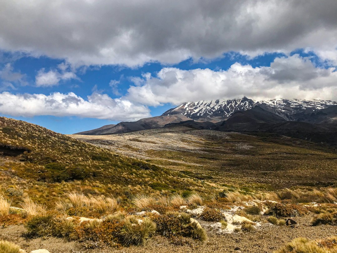
What follows over the next nineteen kilometres or so — the standard transit from Mangatepopo to Ketetahi — is less a hike in the conventional sense than an extended negotiation with a mountain that changes its mind every few hundred metres. The Crossing has become one of the most heavily booked single-day walks in the world, and the reasons are visible within the first half hour: a slow pull up through alpine tussock, then the sudden, disorienting arrival at South Crater, a flat floor of volcanic rubble that feels like the surface of another planet. People stop here. Some stop for a long time. The silence is what gets mentioned most often when walkers try to describe it afterward.
The logistics are the part most people grapple with before they ever lace a boot. The Crossing sits inside Tongariro National Park, a dual World Heritage site on the central North Island, and it can only be walked in one direction as a through-route for most visitors — Mangatepopo to Ketetahi — with a shuttle required at both ends unless a very specific car-swap arrangement is organised. Bookings through the official system are required during the peak season, and the daily cap means late planners often find themselves choosing between a date that doesn’t suit them and no date at all. The shuttle operators who run from nearby towns — National Park Village, Turangi, Whakapapa — tend to fill their seats early, and the first departures usually leave in the dark, headlights catching the frost on the tussock.
A common surprise for first-timers is the cost of the small stuff. A shuttle seat plus a DOC hut or car park booking plus a decent packed lunch and a water top-up can run well past a hundred dollars for a single day, and the prices at the small general stores near the trailheads reflect the remoteness — a packet of nuts and a chocolate bar can cost close to ten dollars, and a hot pie at the end of the day feels like a bargain at almost any price. Walkers who arrive assuming the cheap-and-easy version of New Zealand’s outdoor culture will apply to the Tongariro corridor tend to recalibrate fast.
The climb to Red Crater is where the day’s mood shifts. Up to that point the walking has been steady but forgiving, a rhythm of step-step-breathe that most moderately fit people can hold. Then the gradient steepens, the path turns to loose scoria that slides back with every footfall, and hands start coming out of pockets. On a clear day the payoff is absurd: the crater’s rim is a raw red-brown, the sulphur vents below stain the rock yellow, and the Emerald Lakes sit in a cluster of mineral blues and greens that look artificially saturated. On a cloudy day the same climb can feel like walking into a fridge, with visibility dropping to a few dozen metres and the wind doing its best to push people off balance. Both versions are common. Neither is guaranteed.
The weather on the mountain has a reputation that isn’t exaggerated, and the stretch past Red Crater down to the Emerald Lakes is where it most often proves the point. Snow, sleet, and high winds can arrive at any time of year, and the temperature at the summit can sit well below the forecast for the valley floor. A ranger at the trailhead was blunt about how quickly a fine morning stops being fine: “People look at the forecast and see twenty degrees and think they’re sorted, eh. Then the cloud comes over the top and you’ve got horizontal sleet and you can’t see the marker poles. I don’t know, maybe they think the mountain’s exaggerating. It isn’t.” There’s a well-documented history of hypothermia incidents and search-and-rescue callouts on the route, and most of them start with walkers who set out in reasonable conditions and were caught by a shift that arrived faster than expected — the sort of thing that reads as obvious in hindsight and isn’t, ever, at the time. A jacket that seems excessive at the car park is often the difference between a hard day and a dangerous one.
Gear advice tends to split into two camps: the minimalists who carry a small pack with a shell, a hat, gloves, water, and food, and the cautious who add a map, a first-aid kit, and an emergency shelter. The middle ground, and the one most experienced walkers on the track seem to land on, is to carry for the worst hour rather than the average one. Sturdy boots with grip matter on the loose sections, and trekking poles — often dismissed as an affectation on easier trails — earn their keep on the descent toward Ketetahi, where the path drops through a long series of switchbacks that punish tired knees. A good rule of thumb passed around the shuttle seats: pack as if the weather will be five degrees colder and one gear worse than forecast, then be pleasantly surprised.
After the Emerald Lakes and the traverse across Central Crater, the path turns north and begins to drop. The change is almost geological in its suddenness — one minute scoria and sulphur, the next a low ceiling of beech and the smell of wet leaf litter after the bare rock. Conversation comes back on this stretch. Walkers who barely spoke on the climb start comparing notes, offering snacks, trading stories about the wind on the summit. Somewhere in the switchbacks below the bush line, a tramper stops to retie a boot and a stranger hands over a spare muesli bar without being asked.
The daily cap keeps numbers within a tolerable band even at the busiest times, and the trail is long enough that groups naturally spread out — a cluster of walkers at the Emerald Lakes, an empty stretch of boardwalk ten minutes later, one lone figure eating lunch with her back to a rock. Some of the most memorable moments happen when a walker pauses on a rise and realises the only sound is wind and the crunch of scoria underfoot. The contrast with the shuttle car park at either end, where dozens of people are adjusting packs and checking phones, is sharp.
The descent to Ketetahi is longer than many first-timers expect, and the final section through the forest feels endless when legs are tired and the light is starting to drop. The car park at the end is a line of shuttles waiting, a few picnic tables, and the odd walker flopped on the grass with boots off. A hot drink from a thermos here tastes better than almost anything else. The shuttle back to National Park Village or Turangi is usually quiet, most passengers asleep or staring out the window at the mountain they’ve just crossed, now framed in the rear view and looking considerably more benign than it did from the inside.
Even the most prepared walkers tend to come away with one thing they’d change. A water bottle left in the car. A layer that got soaked. A phone battery that died at the summit. A booking made for a day the forecast turned foul. The Crossing has a way of teaching its own lessons in real time. The wind at Red Crater doesn’t care how many photos of it exist online. It just keeps blowing, and the walker either bends into it or turns around — then catches the shuttle back down and watches the summit disappear into cloud, already wondering about next time.

📷 Photos: sara nudaveritas (Unsplash), Olly Dow (Unsplash)