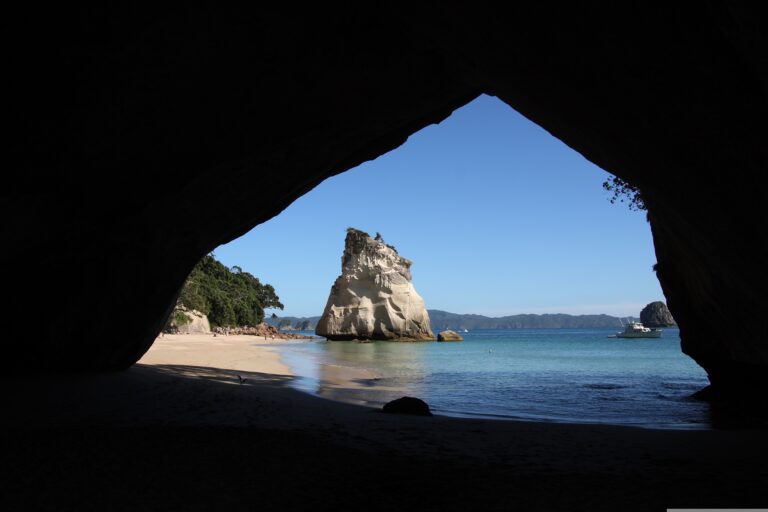
New Zealand’s South Island Circuit: Glaciers to Fiords — Days 4–7
The morning light filtering through the rainforest canopy outside a Franz Josef campsite feels different today — softer, hazier, carrying the particular stillness that settles over the West Coast before the westerlies pick up again. The past few days have been spent with a nose pressed against the wild edge of this island, from the Southern Alps to the Tasman Sea, and now the route begins its deliberate pivot inland. This is the day the character of the journey changes entirely: the West Coast rain drumming on a campervan roof will be left behind, the road turns southeast toward the interior, and the landscapes open into something almost impossibly different.
Before pointing the van toward Haast Pass, there’s one last West Coast encounter not to skip. Fox Glacier sits a short drive south of Franz Josef, and while Franz Josef’s ice front was visible from the valley floor the day before, Fox offers a subtly different perspective — the terminal face is broader, the approach feels more intimate, and the walkway to the viewing point is shorter and more accessible. Park the van in the Fox Glacier car park, lace up whatever footwear has been used for short walks so far, and follow the path out across the grey schist riverbed. The glacier rears up ahead like a frozen avalanche caught mid-crash, crevasses glowing that impossible blue even when the sky above is a solid sheet of white. Give it at least an hour to stand and watch, to listen for the low rumble of ice shifting somewhere invisible, to understand why this coast draws people from across the world just to stand in one spot and stare at something that has been moving for millennia.
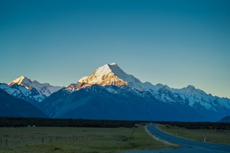
Just a few minutes further south, Lake Matheson demands a decision. The postcards show the perfect mirror reflection of Aoraki Mount Cook and Mount Tasman in the still, dark water, and the cynical part of you might wonder if it’s just a photographer’s trick. It isn’t. The reflection really does sit that still, that clear, provided you arrive early enough to beat the breeze that kicks up by midmorning. The loop track around the lake takes about ninety minutes at a leisurely pace, winding through ancient rimu and kahikatea forest, boardwalks crossing over peat-dark streams, and several viewing platforms that frame the mountains in ways that feel almost designed. If you’re driving a campervan with a diesel heater and you’ve been waking early anyway, this is the morning to use that habit: arrive at the lake carpark by seven, make a thermos of coffee from the van kitchen, and take the track counterclockwise to the jetty viewpoint first. You’ll have the lake to yourself, and you’ll leave before the tour buses arrive.
The road south from Fox to Haast township is a study in diminishing scale. The mountains grow closer, the rainforest thickens, and then suddenly the highway narrows and you’re tracing the edge of the Haast River through gorges so steep they seem to swallow the daylight. This stretch of State Highway 6 is one of the great driving roads in New Zealand, and it demands full attention — not because it’s dangerous in the way the alpine passes can be, but because every corner reveals something you want to stop for. The campervan’s weight makes itself known on the uphill sections, and you learn to drop down a gear before the hairpins rather than halfway through them. There are pull-offs every few kilometres, many marked with Department of Conservation signs pointing to short walks: the Blue Pools, where the water is so clear you can count the pebbles on the bottom from the swing bridge; Thunder Creek Falls, a thirty-second walk from the road to a cascade that plunges into a pool the colour of weak tea; Fantail Falls, where you can scramble down to the riverbed and feel the spray on your face.
By the time you crest the Haast Pass summit marker, you’ve crossed an invisible boundary. The West Coast’s saturated greens and perpetual damp give way, over the course of about twenty kilometres of descending road, to the drier golden-brown of Central Otago’s eastern flanks. The vegetation changes, the air dries out, and the views open into wide valleys where the braided rivers spread across gravel beds like fingers. You find yourself pulling over just to take a photograph of nothing in particular — just the sheer breadth of the landscape, the way the light falls differently here, the way the campervan feels suddenly small against a horizon that keeps receding.
The target for the end of Day 4 is Wanaka, and you arrive in the late afternoon with just enough light to find your spot. The Wanaka lakefront campsite is a popular choice for a reason: it’s right on the edge of the lake, within walking distance of the town’s cafes and the supermarket, and the view from the van’s back door is of the water and the mountains beyond. Book ahead in peak season — this site fills quickly — and aim for a spot near the lake side of the camping area rather than the road side, because the sound of water lapping against the shore is a better lullaby than the hum of passing traffic. The town itself has a good supermarket (New World, on the main road) where you can restock on fresh produce, and a bakery that does a creditable pie if you’ve been craving something hot that doesn’t require lighting the gas stove.
Day 5 is the full day in Wanaka, and the question is whether to go up or stay down. The Rob Roy Glacier track is the region’s standout day hike, and you need to drive about an hour up the Matukituki Valley to reach the trailhead — the campervan handles the unsealed road without trouble if taken slowly, but check the weather forecast before committing, because the valley can trap cloud and the track becomes slippery and disappointing in rain. The walk itself climbs gradually through beech forest, crosses several swing bridges over braided river channels, and then opens into a hanging valley where the glacier spills down a near-vertical cliff face in a series of waterfalls that seem to hang in midair. The round trip takes about four hours at a steady pace, and you want to carry water and a packed lunch from the van kitchen — there’s nowhere to buy food once you leave town.
If the weather isn’t cooperating, or if the legs need a rest day, Wanaka offers the kind of low-key pleasures that make campervan life feel luxurious. Puzzling World is exactly as odd as it sounds — a collection of optical illusions, a tilted room that will confuse your inner ear, and a maze of hedges that takes longer to solve than you expect. It’s the sort of place that could feel touristy and cynical, but it’s been here long enough to earn its quirks honestly, and an hour wandering through the illusion rooms is a genuinely pleasant way to spend a rainy afternoon. More importantly, the grounds have ample campervan parking and clean toilets, which makes it a practical stop even if you just need a break from driving.
The evening of Day 5 is the second night at the Wanaka lakefront, and you should lean into the rhythm of settling in. Cook something that requires a bit more effort than usual — the gas burner on the van’s stove can handle a decent stir-fry or a one-pot pasta, and the supermarket’s produce section has good vegetables this far south. Walk down to the lake edge after dinner, when the day-trippers have gone and the water turns the colour of a bruise in the fading light. The famous Wanaka tree — the lone willow growing from the shallows, photographed so many times it’s become a cliché — is still worth seeing in person, if only because the actual experience of standing there, in the quiet, with the mountains behind it, feels nothing like the Instagram version.
Day 6 is the day the campervan earns its keep. The Crown Range Road connects Wanaka to Queenstown, and it is one of the most exhilarating and demanding drives on this entire trip. The road climbs steeply from the Cardrona Valley, winding through switchbacks that require dropping into second gear on the ascent and using engine braking rather than the foot brake on the descent — a lesson many campervan drivers learn the hard way when they smell their brakes overheating halfway down. Take it slow. Pull over at the designated viewpoints. The views from the top of the Crown Range are expansive enough to make you forget the white-knuckle corners, a panorama of wrinkled brown hills stretching to the distant peaks of the Southern Alps. There’s a small historic hotel at Cardrona, midway along the route, where you can grab a coffee and use decent toilets, but don’t plan on anything more elaborate — the road is the attraction here, not the stops along it.
About halfway between the Crown Range summit and Queenstown, you drop into Arrowtown, and you should stop. This former gold-mining settlement has been polished into a tourist town, but the core of it — the main street lined with mature trees, the preserved Chinese settlement cottages, the Arrow River running clear and cold through the centre — still holds enough authenticity to justify an hour of your time. Park the campervan in the large carpark near the river, walk along the main street, and buy an ice cream from the shop near the clock tower even if the weather is cool. Arrowtown has a particular afternoon light that makes everything look like a photograph from the 1920s, and it’s a good place to decompress from the Crown Range before descending into the commercial juggernaut of Queenstown.
Queenstown itself is a shock to the system after the relative quiet of the West Coast and Wanaka. The town is busy, expensive, and relentlessly focused on tourism, and the campervan feels less like an adventure vehicle and more like a practical necessity as you navigate the tight streets and search for parking. The Queenstown Holiday Park, where you base yourself for the night, is well-equipped and centrally located, with powered sites, clean shower blocks, and a communal kitchen that makes you grateful for the chance to cook without balancing a pan on a two-burner stove. Book ahead — Queenstown accommodation is tight year-round, and campervan sites fill even faster than hotel rooms.
The Skyline Gondola is the obvious Queenstown activity, and it’s worth doing despite the tourist premium. The ride up gives a view of the town, the lake, and the Remarkables that you simply can’t get any other way, and the luge track at the top is genuinely fun — you’ll feel slightly ridiculous sitting in a plastic cart with a helmet on, but you’ll also want to go again. The restaurant at the top is overpriced for what it serves, so consider eating dinner from the van instead, using the holiday park’s kitchen facilities, and taking the gondola up later in the afternoon when the light is golden and the crowds have thinned. The walking track from the top of the gondola along the ridgeline is free, offers panoramic views in every direction, and takes about forty minutes round trip — a better use of time than queuing for the buffet.
Day 7 sends you north out of Queenstown toward Glenorchy, and the journey begins to feel like it’s building toward something. The drive along the edge of Lake Wakatipu is forty minutes of road that seems designed specifically to make you pull over and stare. The lake is a deep, startling blue, the mountains on the far shore rise directly from the water, and the road hugs the shoreline so closely that you feel like you’re driving across the surface of the lake itself. Glenorchy, when you arrive, is a tiny settlement at the head of the lake, set against a backdrop of peaks that look like they were drawn by someone who had never seen a mountain and was trying to imagine what one should look like — improbably steep, impossibly close.
Beyond Glenorchy, the road continues into the valley known as Paradise, and the name is not an exaggeration. The gravel road winds through farmland, past stands of red beech and silver beech, across swing bridges over rivers the colour of milky jade, and eventually to the start of the Routeburn Track. There’s no time to walk the full Routeburn — that’s a multi-day tramp requiring hut bookings made months in advance — but the first hour of the track, from the trailhead up through forest to the first clearing, gives a genuine taste of what makes this one of New Zealand’s Great Walks. The track is well-graded, the forest is cathedral-like in its stillness, and the sound of the Routeburn River below provides a constant background hum. Give yourself two hours for a return walk to a point where you feel satisfied — you don’t need to reach a specific destination, just to have walked into that landscape far enough to feel its scale.
The campsite for the night is the Glenorchy DOC campground, a basic but beautiful spot on the edge of the lake with long-drop toilets, cold running water, and a view that makes up for every missing amenity. There are no showers here, and no powered sites, but the campervan’s built-in shower tank has enough hot water for a quick rinse if you’ve been prudent with usage. Cook dinner outside if the weather allows — the evenings here are still enough that you can hear the river from across the valley — and watch the light fade off the mountains in stages, the peaks catching the last of the sun while the valley floor sinks into shadow. The road south to Te Anau and Milford Sound waits for tomorrow. For tonight, Glenorchy offers quiet, darkness, and the sense that you’ve arrived somewhere that still belongs more to the landscape than to the people passing through it.